

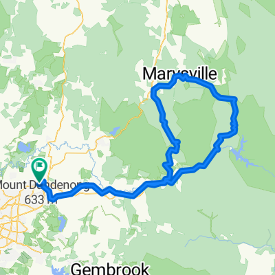
Bunyip Overnighter
A cycling route starting in Lilydale, Victoria, Australia.
Overview
About this route
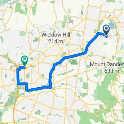
Lilydale - Mount Evelyn - Wandin North - Seville - Gruyere - Seville East - Woori Yallock - Yellingbo - Hoddles Creek - Beenak - Gembrook - Gentle Annie - Cockatoo - Avonsleigh - Emerald - Menzies Creek - Selby - Belgrave
- 16 h 42 min
- Duration
- 112.9 km
- Distance
- 2,087 m
- Ascent
- 1,953 m
- Descent
- 6.8 km/h
- Avg. speed
- 590 m
- Max. altitude
Continue with Bikemap
Use, edit, or download this cycling route
You would like to ride Bunyip Overnighter or customize it for your own trip? Here is what you can do with this Bikemap route:
Free features
- Save this route as favorite or in collections
- Copy & plan your own version of this route
- Split it into stages to create a multi-day tour
- Sync your route with Garmin or Wahoo
Premium features
Free trial for 3 days, or one-time payment. More about Bikemap Premium.
- Navigate this route on iOS & Android
- Export a GPX / KML file of this route
- Create your custom printout (try it for free)
- Download this route for offline navigation
Discover more Premium features.
Get Bikemap PremiumFrom our community
Other popular routes starting in Lilydale
 Lilydale-Warburton Rail Trail
- Distance
- 39.2 km
- Ascent
- 292 m
- Descent
- 236 m
- Location
- Lilydale, Victoria, Australia
 Lilydale to Yarra Junction
- Distance
- 31.7 km
- Ascent
- 337 m
- Descent
- 313 m
- Location
- Lilydale, Victoria, Australia
 Bike tour in the Yarra!
- Distance
- 183.9 km
- Ascent
- 3,474 m
- Descent
- 3,473 m
- Location
- Lilydale, Victoria, Australia
 Lilydale to Yering and return
- Distance
- 19.3 km
- Ascent
- 85 m
- Descent
- 84 m
- Location
- Lilydale, Victoria, Australia
 From Lilydale to Doncaster East
- Distance
- 30.1 km
- Ascent
- 320 m
- Descent
- 373 m
- Location
- Lilydale, Victoria, Australia
 15-01-01 Lilydale-Mt Evelyn via Rail Trail
- Distance
- 14.8 km
- Ascent
- 170 m
- Descent
- 172 m
- Location
- Lilydale, Victoria, Australia
 Nathan Ct, Mooroolbark to Ringwood St, Ringwood
- Distance
- 21 km
- Ascent
- 149 m
- Descent
- 171 m
- Location
- Lilydale, Victoria, Australia
 Lilydale Stn to Warburton Rail Trail
- Distance
- 40.3 km
- Ascent
- 476 m
- Descent
- 422 m
- Location
- Lilydale, Victoria, Australia
Open it in the app