

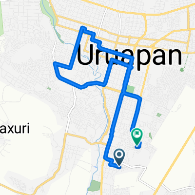
Tzipekua 64, Uruapan a Nogal 700, Uruapan
A cycling route starting in Santa Rosa (Santa Bárbara), Michoacán, Mexico.
Overview
About this route
- 34 min
- Duration
- 7.5 km
- Distance
- 102 m
- Ascent
- 61 m
- Descent
- 13.4 km/h
- Avg. speed
- 1,618 m
- Max. altitude

Route quality
Waytypes & surfaces along the route
Waytypes
Quiet road
4.5 km
(60 %)
Access road
0.1 km
(1 %)
Undefined
2.9 km
(39 %)
Surfaces
Paved
0.6 km
(8 %)
Asphalt
0.6 km
(8 %)
Undefined
6.9 km
(92 %)
Continue with Bikemap
Use, edit, or download this cycling route
You would like to ride Tzipekua 64, Uruapan a Nogal 700, Uruapan or customize it for your own trip? Here is what you can do with this Bikemap route:
Free features
- Save this route as favorite or in collections
- Copy & plan your own version of this route
- Sync your route with Garmin or Wahoo
Premium features
Free trial for 3 days, or one-time payment. More about Bikemap Premium.
- Navigate this route on iOS & Android
- Export a GPX / KML file of this route
- Create your custom printout (try it for free)
- Download this route for offline navigation
Discover more Premium features.
Get Bikemap PremiumFrom our community
Other popular routes starting in Santa Rosa (Santa Bárbara)
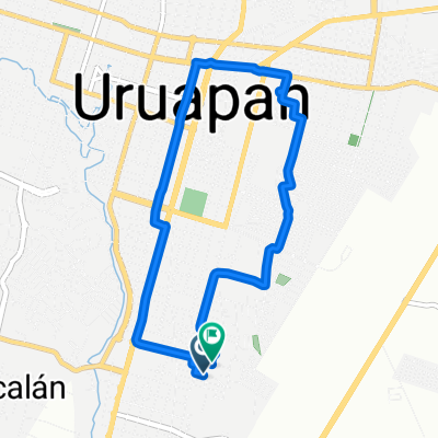
 De Hermanos Flores Magón a Fernando Montes de Oca
- Distance
- 13.7 km
- Ascent
- 202 m
- Descent
- 192 m
- Location
- Santa Rosa (Santa Bárbara), Michoacán, Mexico
 uruapan ruinas volcanicas
- Distance
- 50.2 km
- Ascent
- 1,009 m
- Descent
- 339 m
- Location
- Santa Rosa (Santa Bárbara), Michoacán, Mexico
 uruapan ruinas volcanicas
- Distance
- 42.4 km
- Ascent
- 1,026 m
- Descent
- 357 m
- Location
- Santa Rosa (Santa Bárbara), Michoacán, Mexico
 enpedrado
- Distance
- 42.6 km
- Ascent
- 522 m
- Descent
- 524 m
- Location
- Santa Rosa (Santa Bárbara), Michoacán, Mexico
 De Calle Lago de Pátzcuaro a Calle Lago de Pátzcuaro
- Distance
- 8.4 km
- Ascent
- 83 m
- Descent
- 62 m
- Location
- Santa Rosa (Santa Bárbara), Michoacán, Mexico
 Privada Manuel Huitzacua 30-A, Uruapan to Privada Manuel Huitzacua 30-A, Uruapan
- Distance
- 5.1 km
- Ascent
- 139 m
- Descent
- 138 m
- Location
- Santa Rosa (Santa Bárbara), Michoacán, Mexico
 san juan volcan
- Distance
- 43.8 km
- Ascent
- 1,236 m
- Descent
- 262 m
- Location
- Santa Rosa (Santa Bárbara), Michoacán, Mexico
 Privada Manuel Huitzacua 32, Uruapan to Privada Manuel Huitzacua 28-A, Uruapan
- Distance
- 6.4 km
- Ascent
- 264 m
- Descent
- 263 m
- Location
- Santa Rosa (Santa Bárbara), Michoacán, Mexico
Open it in the app