

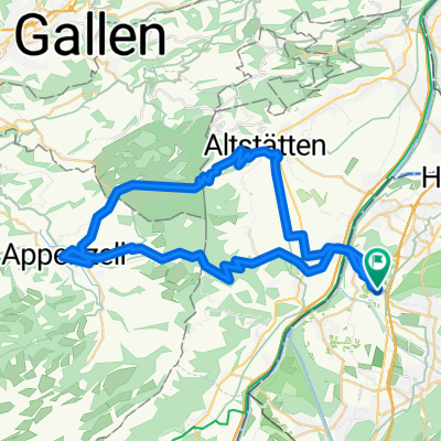
Koblach Appenzell Stoss
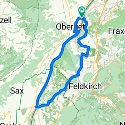
A cycling route starting in Koblach, Vorarlberg, Austria.
Overview
About this route
The approach to Appenzell, behind Oberried, is via a shaded, gently and regularly climbing paved road. Only a short section between Wattwald and Tonisweid is (well) gravelled.
The route is excellently signposted, just always follow 'Eggerstanden'.
From Appenzell, the road climbs three or four kilometers via Gaiß to the Stoss. From there, the descent runs along a busy main road back to Appenzell. A cycle route leads back towards Oberried.
- -:--
- Duration
- 52 km
- Distance
- 749 m
- Ascent
- 747 m
- Descent
- ---
- Avg. speed
- ---
- Max. altitude
Route quality
Waytypes & surfaces along the route
Waytypes
Quiet road
21.3 km
(41 %)
Road
6.8 km
(13 %)
Surfaces
Paved
45.7 km
(88 %)
Unpaved
4.2 km
(8 %)
Asphalt
45.2 km
(87 %)
Gravel
3.6 km
(7 %)
Continue with Bikemap
Use, edit, or download this cycling route
You would like to ride Koblach Appenzell Stoss or customize it for your own trip? Here is what you can do with this Bikemap route:
Free features
- Save this route as favorite or in collections
- Copy & plan your own version of this route
- Sync your route with Garmin or Wahoo
Premium features
Free trial for 3 days, or one-time payment. More about Bikemap Premium.
- Navigate this route on iOS & Android
- Export a GPX / KML file of this route
- Create your custom printout (try it for free)
- Download this route for offline navigation
Discover more Premium features.
Get Bikemap PremiumFrom our community
Other popular routes starting in Koblach
 Walensee special
- Distance
- 130.7 km
- Ascent
- 2,397 m
- Descent
- 2,398 m
- Location
- Koblach, Vorarlberg, Austria
 Koblach Appenzell Stoss
- Distance
- 52 km
- Ascent
- 749 m
- Descent
- 747 m
- Location
- Koblach, Vorarlberg, Austria
 Kl. Walgautour
- Distance
- 48.7 km
- Ascent
- 221 m
- Descent
- 223 m
- Location
- Koblach, Vorarlberg, Austria
 Vorderwald
- Distance
- 121.7 km
- Ascent
- 953 m
- Descent
- 953 m
- Location
- Koblach, Vorarlberg, Austria
 Koblach-Chur-Lenzerheide-Davos-Susch
- Distance
- 148.6 km
- Ascent
- 2,534 m
- Descent
- 1,594 m
- Location
- Koblach, Vorarlberg, Austria
 Hopfentour 1
- Distance
- 137 km
- Ascent
- 405 m
- Descent
- 409 m
- Location
- Koblach, Vorarlberg, Austria
 Schellenberg
- Distance
- 40.5 km
- Ascent
- 227 m
- Descent
- 226 m
- Location
- Koblach, Vorarlberg, Austria
 Säntis Schwägalp - MTB
- Distance
- 99.1 km
- Ascent
- 2,410 m
- Descent
- 2,408 m
- Location
- Koblach, Vorarlberg, Austria
Open it in the app