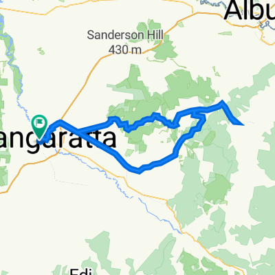
Tony's Tribe Cycling Holiday 1
A cycling route starting in Wangaratta, Victoria, Australia.
Overview
About this route
- -:--
- Duration
- 316.7 km
- Distance
- 2,556 m
- Ascent
- 2,559 m
- Descent
- ---
- Avg. speed
- 595 m
- Max. altitude
Route quality
Waytypes & surfaces along the route
Waytypes
Cycleway
272.4 km
(86 %)
Quiet road
31.7 km
(10 %)
Surfaces
Paved
259.7 km
(82 %)
Unpaved
19 km
(6 %)
Asphalt
180.5 km
(57 %)
Paved (undefined)
79.2 km
(25 %)
Continue with Bikemap
Use, edit, or download this cycling route
You would like to ride Tony's Tribe Cycling Holiday 1 or customize it for your own trip? Here is what you can do with this Bikemap route:
Free features
- Save this route as favorite or in collections
- Copy & plan your own version of this route
- Split it into stages to create a multi-day tour
- Sync your route with Garmin or Wahoo
Premium features
Free trial for 3 days, or one-time payment. More about Bikemap Premium.
- Navigate this route on iOS & Android
- Export a GPX / KML file of this route
- Create your custom printout (try it for free)
- Download this route for offline navigation
Discover more Premium features.
Get Bikemap PremiumFrom our community
Other popular routes starting in Wangaratta
- Wangaratta, Greta, Glenrowan, Wangaratta
- Distance
- 50.9 km
- Ascent
- 98 m
- Descent
- 94 m
- Location
- Wangaratta, Victoria, Australia
- Untitled route
- Distance
- 257.3 km
- Ascent
- 1,873 m
- Descent
- 1,875 m
- Location
- Wangaratta, Victoria, Australia
- Wangaratta -Myrtleford rail trail
- Distance
- 56.2 km
- Ascent
- 269 m
- Descent
- 210 m
- Location
- Wangaratta, Victoria, Australia
- Wangaratta to Myrtleford-alt
- Distance
- 54.7 km
- Ascent
- 251 m
- Descent
- 190 m
- Location
- Wangaratta, Victoria, Australia
- Wangaratta-Myrtleford-Bright rail trail
- Distance
- 83.3 km
- Ascent
- 354 m
- Descent
- 184 m
- Location
- Wangaratta, Victoria, Australia
- Wangaratta to Lilydale Bush Tour
- Distance
- 494.7 km
- Ascent
- 4,949 m
- Descent
- 4,997 m
- Location
- Wangaratta, Victoria, Australia
- Wangaratta to Albury
- Distance
- 112.9 km
- Ascent
- 1,057 m
- Descent
- 1,050 m
- Location
- Wangaratta, Victoria, Australia
- milawa loop
- Distance
- 23.5 km
- Ascent
- 22 m
- Descent
- 22 m
- Location
- Wangaratta, Victoria, Australia
Open it in the app