

Recovery
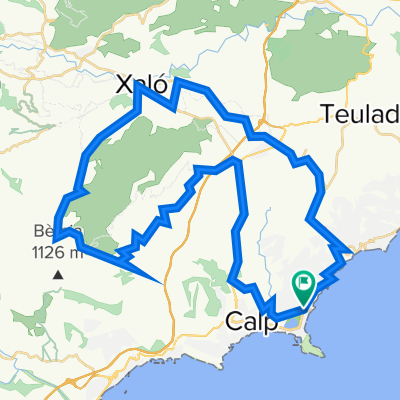
A cycling route starting in Calpe, Valencia, Spain.
Overview
About this route
Travel day
- -:--
- Duration
- 61.1 km
- Distance
- 1,136 m
- Ascent
- 1,136 m
- Descent
- ---
- Avg. speed
- 619 m
- Max. altitude
Route highlights
Points of interest along the route
Accommodation after 0 km
Continue with Bikemap
Use, edit, or download this cycling route
You would like to ride Recovery or customize it for your own trip? Here is what you can do with this Bikemap route:
Free features
- Save this route as favorite or in collections
- Copy & plan your own version of this route
- Sync your route with Garmin or Wahoo
Premium features
Free trial for 3 days, or one-time payment. More about Bikemap Premium.
- Navigate this route on iOS & Android
- Export a GPX / KML file of this route
- Create your custom printout (try it for free)
- Download this route for offline navigation
Discover more Premium features.
Get Bikemap PremiumFrom our community
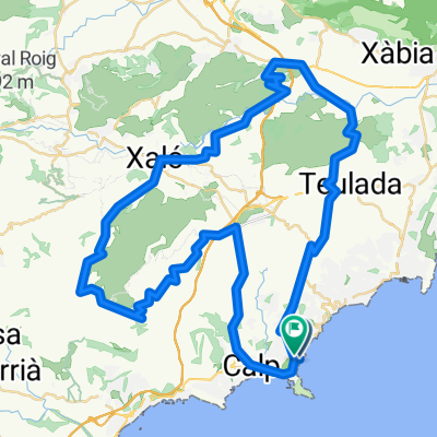
Other popular routes starting in Calpe
 Recovery
- Distance
- 61.1 km
- Ascent
- 1,136 m
- Descent
- 1,136 m
- Location
- Calpe, Valencia, Spain
 Stage4
- Distance
- 118.1 km
- Ascent
- 1,683 m
- Descent
- 1,688 m
- Location
- Calpe, Valencia, Spain
 Astrik Calpe dag 1
- Distance
- 97.7 km
- Ascent
- 1,274 m
- Descent
- 1,274 m
- Location
- Calpe, Valencia, Spain
 Calpe rit 74km
- Distance
- 74.6 km
- Ascent
- 1,005 m
- Descent
- 1,000 m
- Location
- Calpe, Valencia, Spain
 Langs de mooie vallei van Lliber!!
- Distance
- 55.6 km
- Ascent
- 598 m
- Descent
- 598 m
- Location
- Calpe, Valencia, Spain
 Altea-Alfaz-Guadlest-Callosa
- Distance
- 55.7 km
- Ascent
- 935 m
- Descent
- 923 m
- Location
- Calpe, Valencia, Spain
 Calpe Semi-Mountainous via Parcent
- Distance
- 87.9 km
- Ascent
- 1,019 m
- Descent
- 1,019 m
- Location
- Calpe, Valencia, Spain
 Astrik Calpe dag 1
- Distance
- 100.1 km
- Ascent
- 1,377 m
- Descent
- 1,379 m
- Location
- Calpe, Valencia, Spain
Open it in the app