

Eus - Cologne
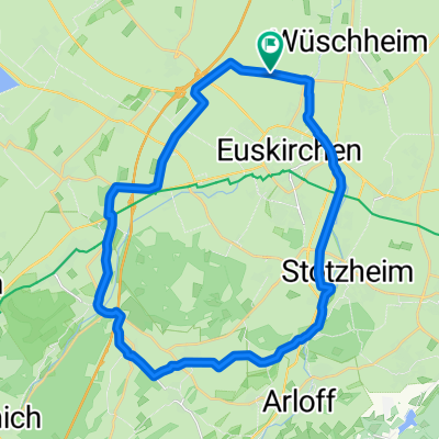
A cycling route starting in Euskirchen, North Rhine-Westphalia, Germany.
Overview
About this route
- -:--
- Duration
- 88.9 km
- Distance
- 610 m
- Ascent
- 723 m
- Descent
- ---
- Avg. speed
- 343 m
- Max. altitude

Route quality
Waytypes & surfaces along the route
Waytypes
Quiet road
31.9 km
(36 %)
Road
16.3 km
(18 %)
Surfaces
Paved
66.5 km
(75 %)
Unpaved
4.4 km
(5 %)
Asphalt
59.8 km
(67 %)
Paved (undefined)
3.4 km
(4 %)
Route highlights
Points of interest along the route
Point of interest after 10.1 km
Point of interest after 13.6 km
Point of interest after 18.5 km
Point of interest after 19.6 km
Point of interest after 22.7 km
Point of interest after 26.6 km
Point of interest after 28.5 km
Point of interest after 29.7 km
Point of interest after 32.6 km
Point of interest after 34.4 km
Point of interest after 35.7 km
Point of interest after 36.8 km
Point of interest after 39.7 km
Point of interest after 42 km
Point of interest after 43.5 km
Point of interest after 46.2 km
Point of interest after 48.5 km
Point of interest after 50.1 km
Point of interest after 52 km
Point of interest after 52.5 km
Point of interest after 63 km
Continue with Bikemap
Use, edit, or download this cycling route
You would like to ride Eus - Cologne or customize it for your own trip? Here is what you can do with this Bikemap route:
Free features
- Save this route as favorite or in collections
- Copy & plan your own version of this route
- Split it into stages to create a multi-day tour
- Sync your route with Garmin or Wahoo
Premium features
Free trial for 3 days, or one-time payment. More about Bikemap Premium.
- Navigate this route on iOS & Android
- Export a GPX / KML file of this route
- Create your custom printout (try it for free)
- Download this route for offline navigation
Discover more Premium features.
Get Bikemap PremiumFrom our community
Other popular routes starting in Euskirchen
 EU-Abendroute (westlich EU)
- Distance
- 20.4 km
- Ascent
- 93 m
- Descent
- 91 m
- Location
- Euskirchen, North Rhine-Westphalia, Germany
 Rund um Euskirchen
- Distance
- 28.8 km
- Ascent
- 142 m
- Descent
- 137 m
- Location
- Euskirchen, North Rhine-Westphalia, Germany
 Kloster Schweinheim
- Distance
- 21.5 km
- Ascent
- 134 m
- Descent
- 136 m
- Location
- Euskirchen, North Rhine-Westphalia, Germany
 Rodderbach 55, Euskirchen nach Rodderbach 55, Euskirchen
- Distance
- 19.1 km
- Ascent
- 160 m
- Descent
- 157 m
- Location
- Euskirchen, North Rhine-Westphalia, Germany
 MTB tour der hoffnung ca. 48KM 800HM
- Distance
- 47.5 km
- Ascent
- 682 m
- Descent
- 689 m
- Location
- Euskirchen, North Rhine-Westphalia, Germany
 EU-Bad Münstereifel-Mechernich: Waldtour
- Distance
- 43.1 km
- Ascent
- 413 m
- Descent
- 404 m
- Location
- Euskirchen, North Rhine-Westphalia, Germany
 Von EU ums BM-Tal
- Distance
- 35.6 km
- Ascent
- 415 m
- Descent
- 423 m
- Location
- Euskirchen, North Rhine-Westphalia, Germany
 Rund um Euskirchen
- Distance
- 28.7 km
- Ascent
- 122 m
- Descent
- 117 m
- Location
- Euskirchen, North Rhine-Westphalia, Germany
Open it in the app