

Altmühl und Urdonau auf Abwegen
A cycling route starting in Rennertshofen, Bavaria, Germany.
Overview
About this route
Charmante Verbindung von Urdonau- und Altmühltal - mit Schleife dran ;)
Die Tour führt durch ruhige, für diese besondere Region charakteristische Täler und Hügellandschaften, vorbei an jeder Menge touristischer Sehenswürdigkeiten: Burgen, Höhlen, Schlösser, Kaplanei, Römerstraßen und Kastell, Felswände. Was begehrt das Herz mehr?
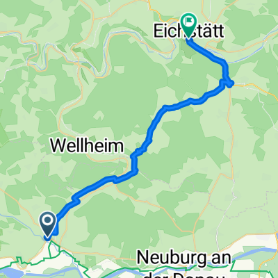
Wellheim - Hütting - (Rennertshofen - Ammerfeld - Bertoldsheim -) Bergen - Nassenfels - Wolkertshofen - Buxheim - Tauberfeld - Pfünz - Eichstätt - Wasserzell - Obereichstätt - Breitenfurt - Dollnstein - Konstein
Die westliche "Blinddarm"-Schleife nach Hütting über Rennertshofen, Ammerfeld und Bertoldsheim ist optional. Sie verlängert die Tour um absolut lohnenswerte ca. 32 Urdonautal-Kilometer.
- -:--
- Duration
- 100 km
- Distance
- 765 m
- Ascent
- 766 m
- Descent
- ---
- Avg. speed
- 538 m
- Max. altitude
Route quality
Waytypes & surfaces along the route
Waytypes
Quiet road
37.3 km
(37 %)
Road
24.2 km
(24 %)
Surfaces
Paved
90.8 km
(91 %)
Unpaved
0.7 km
(<1 %)
Asphalt
90.1 km
(90 %)
Gravel
0.7 km
(<1 %)
Continue with Bikemap
Use, edit, or download this cycling route
You would like to ride Altmühl und Urdonau auf Abwegen or customize it for your own trip? Here is what you can do with this Bikemap route:
Free features
- Save this route as favorite or in collections
- Copy & plan your own version of this route
- Split it into stages to create a multi-day tour
- Sync your route with Garmin or Wahoo
Premium features
Free trial for 3 days, or one-time payment. More about Bikemap Premium.
- Navigate this route on iOS & Android
- Export a GPX / KML file of this route
- Create your custom printout (try it for free)
- Download this route for offline navigation
Discover more Premium features.
Get Bikemap PremiumFrom our community
Other popular routes starting in Rennertshofen
 DO5 Neuburg - Kinding
- Distance
- 73.3 km
- Ascent
- 145 m
- Descent
- 161 m
- Location
- Rennertshofen, Bavaria, Germany
 Bergstrecke Links oder rechts herum
- Distance
- 45.6 km
- Ascent
- 729 m
- Descent
- 703 m
- Location
- Rennertshofen, Bavaria, Germany
 5aa Rennertshofen Bad Gogging 71km
- Distance
- 70.2 km
- Ascent
- 81 m
- Descent
- 120 m
- Location
- Rennertshofen, Bavaria, Germany
 Radltour Wellheim über Pfünz Eichstätt und Dollnstein zurück
- Distance
- 54.1 km
- Ascent
- 285 m
- Descent
- 284 m
- Location
- Rennertshofen, Bavaria, Germany
 Unbenannte Route
- Distance
- 27.3 km
- Ascent
- 315 m
- Descent
- 316 m
- Location
- Rennertshofen, Bavaria, Germany
 Bertholzheim- Neuburg
- Distance
- 33.7 km
- Ascent
- 212 m
- Descent
- 212 m
- Location
- Rennertshofen, Bavaria, Germany
 Bergstrecke Links oder rechts herum
- Distance
- 45.6 km
- Ascent
- 730 m
- Descent
- 704 m
- Location
- Rennertshofen, Bavaria, Germany
 Altmühl und Urdonau auf Abwegen
- Distance
- 100 km
- Ascent
- 765 m
- Descent
- 766 m
- Location
- Rennertshofen, Bavaria, Germany
Open it in the app