

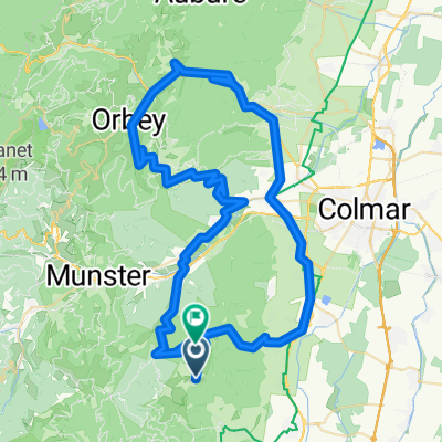
westhal savern 116 620
A cycling route starting in Soultzmatt, Grand Est, France.
Overview
About this route
- -:--
- Duration
- 116.1 km
- Distance
- 790 m
- Ascent
- 902 m
- Descent
- ---
- Avg. speed
- 321 m
- Max. altitude

Route quality
Waytypes & surfaces along the route
Waytypes
Quiet road
38.3 km
(33 %)
Track
25.5 km
(22 %)
Surfaces
Paved
82.4 km
(71 %)
Unpaved
1.2 km
(1 %)
Asphalt
66.2 km
(57 %)
Paved (undefined)
12.8 km
(11 %)
Continue with Bikemap
Use, edit, or download this cycling route
You would like to ride westhal savern 116 620 or customize it for your own trip? Here is what you can do with this Bikemap route:
Free features
- Save this route as favorite or in collections
- Copy & plan your own version of this route
- Split it into stages to create a multi-day tour
- Sync your route with Garmin or Wahoo
Premium features
Free trial for 3 days, or one-time payment. More about Bikemap Premium.
- Navigate this route on iOS & Android
- Export a GPX / KML file of this route
- Create your custom printout (try it for free)
- Download this route for offline navigation
Discover more Premium features.
Get Bikemap PremiumFrom our community
Other popular routes starting in Soultzmatt
 Vogesen II
- Distance
- 101.4 km
- Ascent
- 2,806 m
- Descent
- 2,321 m
- Location
- Soultzmatt, Grand Est, France
 Route nach D40, 68570 Osenbach
- Distance
- 86.5 km
- Ascent
- 2,583 m
- Descent
- 2,445 m
- Location
- Soultzmatt, Grand Est, France
 Vosges deluxe #4
- Distance
- 186.4 km
- Ascent
- 3,752 m
- Descent
- 3,752 m
- Location
- Soultzmatt, Grand Est, France
 quäldich.de - Vogesen, E1 - Auberge du Boenlesgrab
- Distance
- 44.4 km
- Ascent
- 721 m
- Descent
- 717 m
- Location
- Soultzmatt, Grand Est, France
 Rte des Crêtes 2013
- Distance
- 113.3 km
- Ascent
- 1,842 m
- Descent
- 1,842 m
- Location
- Soultzmatt, Grand Est, France
 Osenbach-Osenbühr
- Distance
- 23.5 km
- Ascent
- 883 m
- Descent
- 885 m
- Location
- Soultzmatt, Grand Est, France
 westhal savern 116 620
- Distance
- 116.1 km
- Ascent
- 790 m
- Descent
- 902 m
- Location
- Soultzmatt, Grand Est, France
 Vogesen II CLONED FROM ROUTE 338990
- Distance
- 101.6 km
- Ascent
- 2,196 m
- Descent
- 2,197 m
- Location
- Soultzmatt, Grand Est, France
Open it in the app