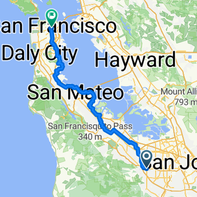
Route to San Gabriel Drive
- 8.4 km
- 56 m
- 58 m
- Cupertino, California, United States
A cycling route starting in Cupertino, California, United States.
Overview
There is water at the Fire Station on Skyline. Then water can be accessed again in Pescadero and at The Bike Hut on Tunitas Creek. Unsure about any sources of water in San Gergorio. Possibly at the store? However, it's less than an hour of riding between Pescadero and The Bike Hut.
created this 14 years ago
Route quality
Road
65.2 km
(45 %)
Cycleway
11.6 km
(8 %)
Paved
84 km
(58 %)
Asphalt
84 km
(58 %)
Undefined
60.9 km
(42 %)
Route highlights

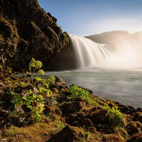
Bateh Brothers

Top of Redwood Gulch

Rudolf

CDF Fire Station

Vista view. In case you decide to take Alpine instead of 84.

Apple Jack's

The Cheese Shop

Duate's

Pescadero deli

San Gregorio Store

The Bike Hut
Continue with Bikemap
You would like to ride To the coast and back V3 or customize it for your own trip? Here is what you can do with this Bikemap route:
Free trial for 3 days, or one-time payment. More about Bikemap Premium.
Discover more Premium features.
Get Bikemap PremiumFrom our community
Open it in the app