

Alsace
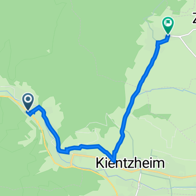
Durch die Hochvogesen zum Lac Blanc - 89km
A cycling route starting in Kaysersberg, Grand Est, France.
Overview
About this route
Varied tour from Kaysersberg via the Hirzberg and Le Bonhomme to Lac Blanc and Lac Noir. The return goes via Barrenkopf and Trois Epis to Kaysersberg - Varied tour from Kaysersberg via the Hirzberg and Le Bonhomme to Lac Blanc and Lac Noir. The return goes via Barrenkopf and Trois Epis to Kaysersberg
- -:--
- Duration
- 88.9 km
- Distance
- 3,370 m
- Ascent
- 3,369 m
- Descent
- ---
- Avg. speed
- 1,215 m
- Max. altitude

Part of
9 stages
Route quality
Waytypes & surfaces along the route
Waytypes
Track
44.4 km
(50 %)
Path
19.5 km
(22 %)
Surfaces
Paved
22.2 km
(25 %)
Unpaved
53.3 km
(60 %)
Ground
34.7 km
(39 %)
Asphalt
16.9 km
(19 %)
Continue with Bikemap
Use, edit, or download this cycling route
You would like to ride Durch die Hochvogesen zum Lac Blanc - 89km or customize it for your own trip? Here is what you can do with this Bikemap route:
Free features
- Save this route as favorite or in collections
- Copy & plan your own version of this route
- Split it into stages to create a multi-day tour
- Sync your route with Garmin or Wahoo
Premium features
Free trial for 3 days, or one-time payment. More about Bikemap Premium.
- Navigate this route on iOS & Android
- Export a GPX / KML file of this route
- Create your custom printout (try it for free)
- Download this route for offline navigation
Discover more Premium features.
Get Bikemap PremiumFrom our community
Other popular routes starting in Kaysersberg
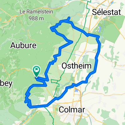 Kaysersberg/Haut Koenigsberg/Alsace Plain/Trois Epis
- Distance
- 81.8 km
- Ascent
- 982 m
- Descent
- 986 m
- Location
- Kaysersberg, Grand Est, France
 Kaysersberg - Colmar - Trois Epis - Kaysersberg
- Distance
- 62.5 km
- Ascent
- 827 m
- Descent
- 827 m
- Location
- Kaysersberg, Grand Est, France
 Tag4 Kaysersberg - Riquewihr
- Distance
- 7.2 km
- Ascent
- 130 m
- Descent
- 108 m
- Location
- Kaysersberg, Grand Est, France
 Route to Kaysersberg-Vignoble
- Distance
- 45.9 km
- Ascent
- 511 m
- Descent
- 477 m
- Location
- Kaysersberg, Grand Est, France
 MurkstourmatLift Vogesen
- Distance
- 57.5 km
- Ascent
- 1,491 m
- Descent
- 1,491 m
- Location
- Kaysersberg, Grand Est, France
 Etappe 5 - KB TVP long Pfaffenheim
- Distance
- 55 km
- Ascent
- 502 m
- Descent
- 502 m
- Location
- Kaysersberg, Grand Est, France
 Route in Kaysersberg-Vignoble
- Distance
- 46 km
- Ascent
- 600 m
- Descent
- 532 m
- Location
- Kaysersberg, Grand Est, France
 From Kaysersberg-Vignoble to Marlenheim
- Distance
- 72.9 km
- Ascent
- 393 m
- Descent
- 463 m
- Location
- Kaysersberg, Grand Est, France
Open it in the app