

Overview
About this route
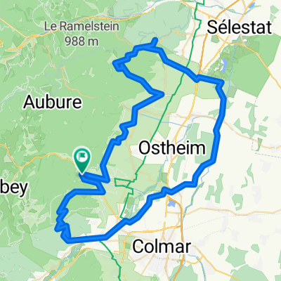
Very strenuous tour through the Vosges, take enough water, 6h of pure riding time, 1900 hm - Very strenuous tour through the Vosges, take enough water, 6h of pure riding time, 1900 hm
- -:--
- Duration
- 70.5 km
- Distance
- 2,211 m
- Ascent
- 2,209 m
- Descent
- ---
- Avg. speed
- 1,170 m
- Max. altitude

Part of
Alsace
9 stages
Route quality
Waytypes & surfaces along the route
Waytypes
Track
37.4 km
(53 %)
Path
13.4 km
(19 %)
Surfaces
Paved
19 km
(27 %)
Unpaved
46.5 km
(66 %)
Ground
27.5 km
(39 %)
Asphalt
14.8 km
(21 %)
Continue with Bikemap
Use, edit, or download this cycling route
You would like to ride Vogessen - 71 Km or customize it for your own trip? Here is what you can do with this Bikemap route:
Free features
- Save this route as favorite or in collections
- Copy & plan your own version of this route
- Sync your route with Garmin or Wahoo
Premium features
Free trial for 3 days, or one-time payment. More about Bikemap Premium.
- Navigate this route on iOS & Android
- Export a GPX / KML file of this route
- Create your custom printout (try it for free)
- Download this route for offline navigation
Discover more Premium features.
Get Bikemap PremiumFrom our community
Other popular routes starting in Kaysersberg
 MurkstourmatLift Vogesen
- Distance
- 57.5 km
- Ascent
- 1,491 m
- Descent
- 1,491 m
- Location
- Kaysersberg, Grand Est, France
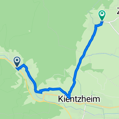
 Kaysersberg - Colmar - Trois Epis - Kaysersberg
- Distance
- 62.5 km
- Ascent
- 827 m
- Descent
- 827 m
- Location
- Kaysersberg, Grand Est, France
 Durch die Hochvogesen zum Lac Blanc
- Distance
- 61.9 km
- Ascent
- 2,382 m
- Descent
- 2,383 m
- Location
- Kaysersberg, Grand Est, France
 Kaysersberg/Haut Koenigsberg/Alsace Plain/Trois Epis
- Distance
- 81.8 km
- Ascent
- 982 m
- Descent
- 986 m
- Location
- Kaysersberg, Grand Est, France
 Etappe 5 - KB TVP long Pfaffenheim
- Distance
- 55 km
- Ascent
- 502 m
- Descent
- 502 m
- Location
- Kaysersberg, Grand Est, France
 Kayserberg Loop
- Distance
- 46.6 km
- Ascent
- 1,913 m
- Descent
- 1,916 m
- Location
- Kaysersberg, Grand Est, France
 Route in Kaysersberg-Vignoble
- Distance
- 46 km
- Ascent
- 600 m
- Descent
- 532 m
- Location
- Kaysersberg, Grand Est, France
 Tag4 Kaysersberg - Riquewihr
- Distance
- 7.2 km
- Ascent
- 130 m
- Descent
- 108 m
- Location
- Kaysersberg, Grand Est, France
Open it in the app