

8den_Z Oberbozen k lanovce
A cycling route starting in Soprabolzano, Trentino-Alto Adige, Italy.
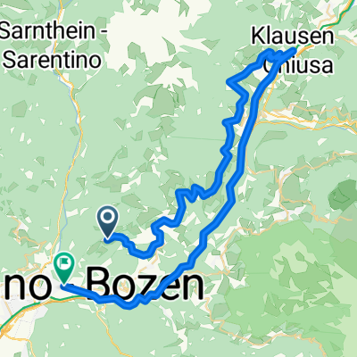
Overview
About this route
- -:--
- Duration
- 10.6 km
- Distance
- 464 m
- Ascent
- 156 m
- Descent
- ---
- Avg. speed
- 1,542 m
- Max. altitude

Route quality
Waytypes & surfaces along the route
Waytypes
Road
4.7 km
(44 %)
Quiet road
2.3 km
(22 %)
Surfaces
Paved
8 km
(76 %)
Unpaved
0.6 km
(6 %)
Asphalt
8 km
(76 %)
Loose gravel
0.6 km
(6 %)
Undefined
1.9 km
(18 %)
Continue with Bikemap
Use, edit, or download this cycling route
You would like to ride 8den_Z Oberbozen k lanovce or customize it for your own trip? Here is what you can do with this Bikemap route:
Free features
- Save this route as favorite or in collections
- Copy & plan your own version of this route
- Sync your route with Garmin or Wahoo
Premium features
Free trial for 3 days, or one-time payment. More about Bikemap Premium.
- Navigate this route on iOS & Android
- Export a GPX / KML file of this route
- Create your custom printout (try it for free)
- Download this route for offline navigation
Discover more Premium features.
Get Bikemap PremiumFrom our community
Other popular routes starting in Soprabolzano
 Bozen-Rittner Horn-Bozen
- Distance
- 51.7 km
- Ascent
- 1,239 m
- Descent
- 2,183 m
- Location
- Soprabolzano, Trentino-Alto Adige, Italy
 Anello Soprabolzano-Corno del Renon-Toten kirche
- Distance
- 24.7 km
- Ascent
- 1,290 m
- Descent
- 390 m
- Location
- Soprabolzano, Trentino-Alto Adige, Italy
 Oberbozen 510
- Distance
- 19.3 km
- Ascent
- 554 m
- Descent
- 556 m
- Location
- Soprabolzano, Trentino-Alto Adige, Italy
 Tour RENON, BZ
- Distance
- 12.4 km
- Ascent
- 109 m
- Descent
- 1,059 m
- Location
- Soprabolzano, Trentino-Alto Adige, Italy
 03.05.16 Oberbozen - Talstation Rittner Horn
- Distance
- 22.8 km
- Ascent
- 521 m
- Descent
- 520 m
- Location
- Soprabolzano, Trentino-Alto Adige, Italy
 Soprabolzano-Vanga-Pennes-Bressanone-Soprabolzano
- Distance
- 134 km
- Ascent
- 3,853 m
- Descent
- 3,801 m
- Location
- Soprabolzano, Trentino-Alto Adige, Italy
 Klausen
- Distance
- 59.3 km
- Ascent
- 506 m
- Descent
- 1,442 m
- Location
- Soprabolzano, Trentino-Alto Adige, Italy
 04.05.2016, Lange Runde Bozen-Leifers-Sarntal
- Distance
- 83.9 km
- Ascent
- 1,281 m
- Descent
- 1,281 m
- Location
- Soprabolzano, Trentino-Alto Adige, Italy
Open it in the app