

De Calle Vista Dorada 6117, Portico de San Antonio a Calle Vista Dorada 6117, Portico de San Antonio
A cycling route starting in Pórticos de San Antonio, Baja California, Mexico.
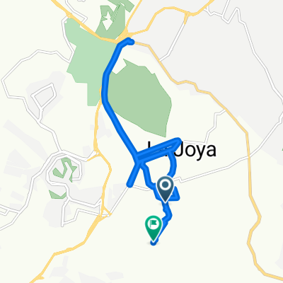
Overview
About this route
- 2 h 59 min
- Duration
- 16.6 km
- Distance
- 505 m
- Ascent
- 504 m
- Descent
- 5.5 km/h
- Avg. speed
- 281 m
- Max. altitude

Route photos


Continue with Bikemap
Use, edit, or download this cycling route
You would like to ride De Calle Vista Dorada 6117, Portico de San Antonio a Calle Vista Dorada 6117, Portico de San Antonio or customize it for your own trip? Here is what you can do with this Bikemap route:
Free features
- Save this route as favorite or in collections
- Copy & plan your own version of this route
- Sync your route with Garmin or Wahoo
Premium features
Free trial for 3 days, or one-time payment. More about Bikemap Premium.
- Navigate this route on iOS & Android
- Export a GPX / KML file of this route
- Create your custom printout (try it for free)
- Download this route for offline navigation
Discover more Premium features.
Get Bikemap PremiumFrom our community
Other popular routes starting in Pórticos de San Antonio
 De Calle P, Tijuana a Paseo de los Héroes 9350, Tijuana
- Distance
- 14 km
- Ascent
- 223 m
- Descent
- 430 m
- Location
- Pórticos de San Antonio, Baja California, Mexico
 Calle Las Flores, Tijuana to Calle Las Flores, Tijuana
- Distance
- 12.4 km
- Ascent
- 213 m
- Descent
- 212 m
- Location
- Pórticos de San Antonio, Baja California, Mexico
 Boulevard Francisco Zarco, Tijuana a Boulevard Santa Fe, Tijuana
- Distance
- 2 km
- Ascent
- 28 m
- Descent
- 56 m
- Location
- Pórticos de San Antonio, Baja California, Mexico
 De Calle Vista Dorada 6117, Portico de San Antonio a Calle Vista Dorada 6117, Portico de San Antonio
- Distance
- 16.6 km
- Ascent
- 505 m
- Descent
- 504 m
- Location
- Pórticos de San Antonio, Baja California, Mexico
 Calle Concepción Velázquez Peña, Tijuana a Calle del Caracol, Tijuana
- Distance
- 15.3 km
- Ascent
- 181 m
- Descent
- 220 m
- Location
- Pórticos de San Antonio, Baja California, Mexico
Open it in the app