
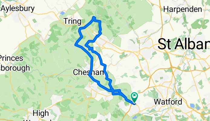
Latimer Aldbury Loop
A cycling route starting in Chorleywood, England, United Kingdom.
Overview
About this route
- -:--
- Duration
- 53.6 km
- Distance
- 397 m
- Ascent
- 397 m
- Descent
- ---
- Avg. speed
- ---
- Max. altitude
Route quality
Waytypes & surfaces along the route
Waytypes
Quiet road
20.8 km
(39 %)
Road
16 km
(30 %)
Surfaces
Paved
23.4 km
(44 %)
Unpaved
0.2 km
(<1 %)
Asphalt
23.2 km
(43 %)
Ground
0.2 km
(<1 %)
Continue with Bikemap
Use, edit, or download this cycling route
You would like to ride Latimer Aldbury Loop or customize it for your own trip? Here is what you can do with this Bikemap route:
Free features
- Save this route as favorite or in collections
- Copy & plan your own version of this route
- Sync your route with Garmin or Wahoo
Premium features
Free trial for 3 days, or one-time payment. More about Bikemap Premium.
- Navigate this route on iOS & Android
- Export a GPX / KML file of this route
- Create your custom printout (try it for free)
- Download this route for offline navigation
Discover more Premium features.
Get Bikemap PremiumFrom our community
Other popular routes starting in Chorleywood
 Croxley-Portsmouth
- Distance
- 123 km
- Ascent
- 483 m
- Descent
- 568 m
- Location
- Chorleywood, England, United Kingdom
 real ride for charity
- Distance
- 41 km
- Ascent
- 110 m
- Descent
- 51 m
- Location
- Chorleywood, England, United Kingdom
 Recording from 30 May 2016, 17:00
- Distance
- 36.1 km
- Ascent
- 215 m
- Descent
- 193 m
- Location
- Chorleywood, England, United Kingdom
 MTB5: Climb to Chorleywood and Ley Hill Loop
- Distance
- 32.3 km
- Ascent
- 293 m
- Descent
- 294 m
- Location
- Chorleywood, England, United Kingdom
 Wendover Woods Cafe route
- Distance
- 26.2 km
- Ascent
- 185 m
- Descent
- 39 m
- Location
- Chorleywood, England, United Kingdom
 Latimer Aldbury Loop
- Distance
- 53.6 km
- Ascent
- 397 m
- Descent
- 397 m
- Location
- Chorleywood, England, United Kingdom
 20 Parkfield, Rickmansworth to Klaproosstraat, Wijchen
- Distance
- 522 km
- Ascent
- 360 m
- Descent
- 460 m
- Location
- Chorleywood, England, United Kingdom
 Based on HarpHilly 100km
- Distance
- 106.9 km
- Ascent
- 773 m
- Descent
- 770 m
- Location
- Chorleywood, England, United Kingdom
Open it in the app