

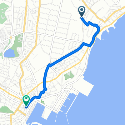
大洗キャンプ場→土浦駅
A cycling route starting in Ōarai, Ibaraki, Japan.
Overview
About this route
- 3 h 16 min
- Duration
- 52.5 km
- Distance
- 300 m
- Ascent
- 320 m
- Descent
- 16.1 km/h
- Avg. speed
- 38 m
- Max. altitude

Route quality
Waytypes & surfaces along the route
Waytypes
Quiet road
24.5 km
(47 %)
Road
23.4 km
(45 %)
Surfaces
Paved
22.5 km
(43 %)
Paved (undefined)
12.6 km
(24 %)
Asphalt
9.9 km
(19 %)
Undefined
30 km
(57 %)
Continue with Bikemap
Use, edit, or download this cycling route
You would like to ride 大洗キャンプ場→土浦駅 or customize it for your own trip? Here is what you can do with this Bikemap route:
Free features
- Save this route as favorite or in collections
- Copy & plan your own version of this route
- Sync your route with Garmin or Wahoo
Premium features
Free trial for 3 days, or one-time payment. More about Bikemap Premium.
- Navigate this route on iOS & Android
- Export a GPX / KML file of this route
- Create your custom printout (try it for free)
- Download this route for offline navigation
Discover more Premium features.
Get Bikemap PremiumFrom our community
Other popular routes starting in Ōarai
 大洗キャンプ場→土浦駅
- Distance
- 52.5 km
- Ascent
- 300 m
- Descent
- 320 m
- Location
- Ōarai, Ibaraki, Japan
 Japón - 3 Parte
- Distance
- 101.3 km
- Ascent
- 389 m
- Descent
- 242 m
- Location
- Ōarai, Ibaraki, Japan
 Oarai Camping Ground to 1-chōme
- Distance
- 55.6 km
- Ascent
- 285 m
- Descent
- 310 m
- Location
- Ōarai, Ibaraki, Japan
 大洗ひたちなかシーサイド&海浜公園
- Distance
- 16.1 km
- Ascent
- 121 m
- Descent
- 98 m
- Location
- Ōarai, Ibaraki, Japan
 896, Okushicho, Mito to 1257-3, Sembacho, Mito
- Distance
- 7.7 km
- Ascent
- 28 m
- Descent
- 3 m
- Location
- Ōarai, Ibaraki, Japan
 Hiraisocho, เมืองฮิตาจินากะ to Minatohoncho, เมืองฮิตาจินากะ
- Distance
- 3.4 km
- Ascent
- 17 m
- Descent
- 36 m
- Location
- Ōarai, Ibaraki, Japan
 Hokota to 3-chōme 2, Mito
- Distance
- 28.2 km
- Ascent
- 128 m
- Descent
- 134 m
- Location
- Ōarai, Ibaraki, Japan
 Hokota to 3-chōme 2, Mito
- Distance
- 28.7 km
- Ascent
- 148 m
- Descent
- 154 m
- Location
- Ōarai, Ibaraki, Japan
Open it in the app