
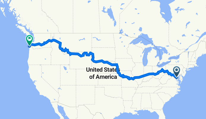
2023 Coast-to-Coast (East-West) FINAL: 03Jun-28Jul2023
A cycling route starting in Washington D.C., District of Columbia, United States.
Overview
About this route
From Arlington, VA to Astoria, OR via a combination of...
-
1315 miles via Rails-to-Trails and The Great American Rail Trail routes
-
1461 miles via ACA routes
-
330 miles via US Bike Route System (USBR)
-
705 miles via various US State Hightways
- -:--
- Duration
- 6,108 km
- Distance
- 25,430 m
- Ascent
- 25,472 m
- Descent
- ---
- Avg. speed
- 2,893 m
- Max. altitude

Continue with Bikemap
Use, edit, or download this cycling route
You would like to ride 2023 Coast-to-Coast (East-West) FINAL: 03Jun-28Jul2023 or customize it for your own trip? Here is what you can do with this Bikemap route:
Free features
- Save this route as favorite or in collections
- Copy & plan your own version of this route
- Split it into stages to create a multi-day tour
- Sync your route with Garmin or Wahoo
Premium features
Free trial for 3 days, or one-time payment. More about Bikemap Premium.
- Navigate this route on iOS & Android
- Export a GPX / KML file of this route
- Create your custom printout (try it for free)
- Download this route for offline navigation
Discover more Premium features.
Get Bikemap PremiumFrom our community
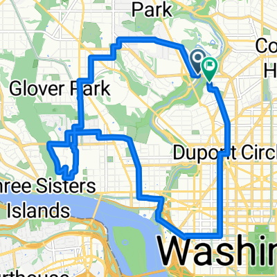
Other popular routes starting in Washington D.C.
 Crescent Trail Morning Ride
- Distance
- 14.9 km
- Ascent
- 179 m
- Descent
- 160 m
- Location
- Washington D.C., District of Columbia, United States
 Georgetown-Rock Creek-Tilden-Tenleytown-Wisconsin Ave.
- Distance
- 15.1 km
- Ascent
- 175 m
- Descent
- 172 m
- Location
- Washington D.C., District of Columbia, United States
 Calvert St NW & Duke Ellington Bridge to Calvert St NW & Duke Ellington Bridge
- Distance
- 14 km
- Ascent
- 192 m
- Descent
- 192 m
- Location
- Washington D.C., District of Columbia, United States
 USA Trip - Tag 15
- Distance
- 448.3 km
- Ascent
- 350 m
- Descent
- 373 m
- Location
- Washington D.C., District of Columbia, United States
 Capital Crescent Trail
- Distance
- 32.1 km
- Ascent
- 227 m
- Descent
- 223 m
- Location
- Washington D.C., District of Columbia, United States
 Capital Crescent - Georgetown Branch - Rock Crek Loop
- Distance
- 32.5 km
- Ascent
- 172 m
- Descent
- 174 m
- Location
- Washington D.C., District of Columbia, United States
 The White House, Lincoln Memorial and Rock Creek Park
- Distance
- 15 km
- Ascent
- 187 m
- Descent
- 187 m
- Location
- Washington D.C., District of Columbia, United States
 Rock Creek Trail, Washington to Rock Creek Trail, Washington
- Distance
- 31.7 km
- Ascent
- 200 m
- Descent
- 196 m
- Location
- Washington D.C., District of Columbia, United States
Open it in the app