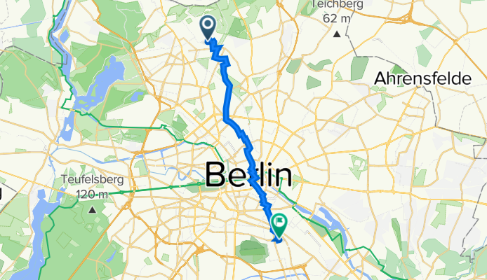
Senftenberger Ring 24, Berlin nach Boddinstraße 16, Berlin
A cycling route starting in Märkisches Viertel, State of Berlin, Germany.
Overview
About this route
- 1 h 8 min
- Duration
- 18 km
- Distance
- 60 m
- Ascent
- 54 m
- Descent
- 15.9 km/h
- Avg. speed
- 56 m
- Max. altitude
Route quality
Waytypes & surfaces along the route
Waytypes
- Quiet road - 6.1 km - (34 %) 
- Road - 3.8 km - (21 %) 
Surfaces
Paved
16.1 km
(89 %)
Unpaved
0.4 km
(2 %)
- Asphalt - 15.7 km - (87 %) 
- Concrete - 0.4 km - (2 %) 
Continue with Bikemap
Use, edit, or download this cycling route
You would like to ride Senftenberger Ring 24, Berlin nach Boddinstraße 16, Berlin or customize it for your own trip? Here is what you can do with this Bikemap route:
Free features
- Save this route as favorite or in collections
- Copy & plan your own version of this route
- Sync your route with Garmin or Wahoo
Premium features
Free trial for 3 days, or one-time payment. More about Bikemap Premium.
- Navigate this route on iOS & Android
- Export a GPX / KML file of this route
- Create your custom printout (try it for free)
- Download this route for offline navigation
Discover more Premium features.
Get Bikemap PremiumFrom our community
Other popular routes starting in Märkisches Viertel
 Eichhorster Weg 46–48, Berlin nach Eichhorster Straße 24, Friedland Eichhorster Weg 46–48, Berlin nach Eichhorster Straße 24, Friedland- Distance
- 146.9 km
- Ascent
- 732 m
- Descent
- 711 m
- Location
- Märkisches Viertel, State of Berlin, Germany
 
 Finsterwalder Straße 16, Berlin nach Markscheiderstraße 30–32, Berlin Finsterwalder Straße 16, Berlin nach Markscheiderstraße 30–32, Berlin- Distance
- 3.1 km
- Ascent
- 14 m
- Descent
- 16 m
- Location
- Märkisches Viertel, State of Berlin, Germany
 
 mittenmang, reinickendorf-schöneberg mittenmang, reinickendorf-schöneberg- Distance
- 18.1 km
- Ascent
- 29 m
- Descent
- 37 m
- Location
- Märkisches Viertel, State of Berlin, Germany
 
 Senftenberger Ring 48, Berlin nach Vierwaldstätter Weg 7, Berlin Senftenberger Ring 48, Berlin nach Vierwaldstätter Weg 7, Berlin- Distance
- 6.5 km
- Ascent
- 20 m
- Descent
- 22 m
- Location
- Märkisches Viertel, State of Berlin, Germany
 
 hausrunde, glienicke, schildow,schönfließ hausrunde, glienicke, schildow,schönfließ- Distance
- 23.2 km
- Ascent
- 59 m
- Descent
- 59 m
- Location
- Märkisches Viertel, State of Berlin, Germany
 
 Mauerweg / Tegeler Fließ Mauerweg / Tegeler Fließ- Distance
- 10.9 km
- Ascent
- 46 m
- Descent
- 54 m
- Location
- Märkisches Viertel, State of Berlin, Germany
 
 👍🏻Vom Mv über Spandau aufs Land nach Seeburg👍🏻 👍🏻Vom Mv über Spandau aufs Land nach Seeburg👍🏻- Distance
- 23.7 km
- Ascent
- 64 m
- Descent
- 66 m
- Location
- Märkisches Viertel, State of Berlin, Germany
 
 Bagger- & Köppchensee Bagger- & Köppchensee- Distance
- 16.3 km
- Ascent
- 61 m
- Descent
- 61 m
- Location
- Märkisches Viertel, State of Berlin, Germany
 
Open it in the app


