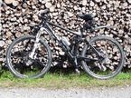
Schwarzenber (Murgtal) - Holohsee - Bad Herrenalb
A cycling route starting in Biberach, Baden-Wurttemberg, Germany.
Overview
About this route
<p>From the Panoramahütte in Schwarzenberg (Murgtal) to Herrenalb. Tour on the Schwarzwladhöhenweg passing Holohsee and descending through the Gaistal.</p>
<p>Ideal combinations with this route:</p>
<ul>
<li>Access by S-Bahn to Bad Wildbad. From Bad Wildbad to Poppeltal and from there to Schwarzenberg to the Panoramahütte</li>
<li>Return from Herrenalb along the Graf Rhenaweg to Ettlingen/Karlsruhe</li>
</ul>
Translated, show original (German)- -:--
- Duration
- 30.8 km
- Distance
- 567 m
- Ascent
- 774 m
- Descent
- ---
- Avg. speed
- ---
- Max. altitude
Route quality
Waytypes & surfaces along the route
Waytypes
Track
28.9 km
(94 %)
Quiet road
0.6 km
(2 %)
Surfaces
Paved
2.2 km
(7 %)
Unpaved
28.6 km
(93 %)
Gravel
24.6 km
(80 %)
Loose gravel
4 km
(13 %)
Asphalt
2.2 km
(7 %)
Continue with Bikemap
Use, edit, or download this cycling route
You would like to ride Schwarzenber (Murgtal) - Holohsee - Bad Herrenalb or customize it for your own trip? Here is what you can do with this Bikemap route:
Free features
- Save this route as favorite or in collections
- Copy & plan your own version of this route
- Sync your route with Garmin or Wahoo
Premium features
Free trial for 3 days, or one-time payment. More about Bikemap Premium.
- Navigate this route on iOS & Android
- Export a GPX / KML file of this route
- Create your custom printout (try it for free)
- Download this route for offline navigation
Discover more Premium features.
Get Bikemap PremiumFrom our community
Other popular routes starting in Biberach
 Schwarzenber (Murgtal) - Holohsee - Bad Herrenalb
- Distance
- 30.8 km
- Ascent
- 567 m
- Descent
- 774 m
- Location
- Biberach, Baden-Wurttemberg, Germany
 Hornisgrinderunde
- Distance
- 23.3 km
- Ascent
- 439 m
- Descent
- 428 m
- Location
- Biberach, Baden-Wurttemberg, Germany
 mit dem MB von Schönmünzach-Baiersbronn-Tonbachtal über den Seekopf zum Seibelseckle und Mummelsee heimwärts den Fernradweg nach Untersmatt, Hundseck, Sand, Rot
- Distance
- 102.3 km
- Ascent
- 773 m
- Descent
- 1,142 m
- Location
- Biberach, Baden-Wurttemberg, Germany
 Genießerpfad zum Panoramastüble
- Distance
- 10.5 km
- Ascent
- 415 m
- Descent
- 413 m
- Location
- Biberach, Baden-Wurttemberg, Germany
 MTB_Schönm-Hornisgr
- Distance
- 16.1 km
- Ascent
- 782 m
- Descent
- 88 m
- Location
- Biberach, Baden-Wurttemberg, Germany
 Murgleiter Schönmünzach bis Baiersbronn
- Distance
- 24.1 km
- Ascent
- 777 m
- Descent
- 706 m
- Location
- Biberach, Baden-Wurttemberg, Germany
 Westweg Wanderroute 4-6
- Distance
- 65.5 km
- Ascent
- 960 m
- Descent
- 1,646 m
- Location
- Biberach, Baden-Wurttemberg, Germany
 Loewen - Besenfeld - Klosterreichenbach - Loewen (Rundtour)
- Distance
- 25.9 km
- Ascent
- 669 m
- Descent
- 669 m
- Location
- Biberach, Baden-Wurttemberg, Germany
Open it in the app


