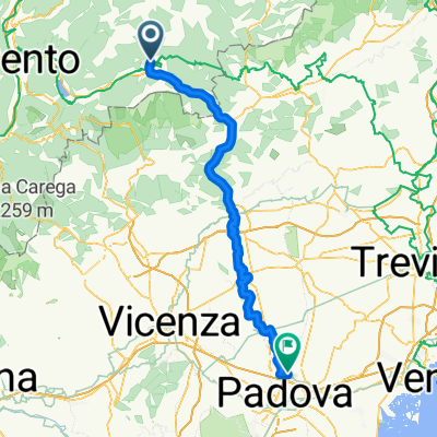
Borgo Valsugana - Forte Busa Runde (63 km)
A cycling route starting in Carzano, Trentino-Alto Adige, Italy.
Overview
About this route
Today, a ride to Forte Busa, located above Levico Terme, on a charming secondary road to cycle, but it stretches as you gain elevation. Mostly around 9%, but sometimes it gets steep. They forecasted 20 degrees, so I only took a light windbreaker, a big mistake in the mountains. At the Refugio Erterle (you gain about 1000 meters relative altitude from Borgo) there is a nice rest area, and then suddenly a cool wind started blowing, mutually of course. In Vetriolo it was already really cold. Up to the Forte with over 300 watts, but I just couldn’t get warm. Down to the lake it was a real ordeal, the icy wind penetrated to the bone and my arms became stiff as boards. Man! I've never frozen so badly on the bike. At the lake it got better because the wind came from behind (I stayed on the road, shiver!). A show ride through the pedestrian zone and a warm-up break in the spa park (walking). Finally, at quarter past three the sun came out and it quickly warmed up, luckily. Return on the VCA, easy with tailwind downhill through the valley. Luckily, nothing stuck afterward.
- -:--
- Duration
- 61.5 km
- Distance
- 2,381 m
- Ascent
- 2,394 m
- Descent
- ---
- Avg. speed
- 1,570 m
- Max. altitude
Route quality
Waytypes & surfaces along the route
Waytypes
Quiet road
32 km
(52 %)
Road
17.2 km
(28 %)
Surfaces
Paved
42.4 km
(69 %)
Unpaved
8 km
(13 %)
Asphalt
41.8 km
(68 %)
Gravel
8 km
(13 %)
Continue with Bikemap
Use, edit, or download this cycling route
You would like to ride Borgo Valsugana - Forte Busa Runde (63 km) or customize it for your own trip? Here is what you can do with this Bikemap route:
Free features
- Save this route as favorite or in collections
- Copy & plan your own version of this route
- Sync your route with Garmin or Wahoo
Premium features
Free trial for 3 days, or one-time payment. More about Bikemap Premium.
- Navigate this route on iOS & Android
- Export a GPX / KML file of this route
- Create your custom printout (try it for free)
- Download this route for offline navigation
Discover more Premium features.
Get Bikemap PremiumFrom our community
Other popular routes starting in Carzano
 Carzano/Borgo to Trento
- Distance
- 46 km
- Ascent
- 373 m
- Descent
- 606 m
- Location
- Carzano, Trentino-Alto Adige, Italy
 Alpen Tag 5 Chioggia
- Distance
- 159 km
- Ascent
- 614 m
- Descent
- 1,060 m
- Location
- Carzano, Trentino-Alto Adige, Italy
 Borgo Valsugana - Forte Busa Runde (63 km)
- Distance
- 61.5 km
- Ascent
- 2,381 m
- Descent
- 2,394 m
- Location
- Carzano, Trentino-Alto Adige, Italy
 Carzano- Forte Leone - Arsiè Runde (89 km)
- Distance
- 86.8 km
- Ascent
- 3,246 m
- Descent
- 3,243 m
- Location
- Carzano, Trentino-Alto Adige, Italy
 Carzano Malga_Conseria (45,2 km)
- Distance
- 43.9 km
- Ascent
- 2,614 m
- Descent
- 2,612 m
- Location
- Carzano, Trentino-Alto Adige, Italy
 3Carzano-Vigodazere
- Distance
- 107.9 km
- Ascent
- 98 m
- Descent
- 515 m
- Location
- Carzano, Trentino-Alto Adige, Italy
 Vicenca
- Distance
- 110.9 km
- Ascent
- 68 m
- Descent
- 478 m
- Location
- Carzano, Trentino-Alto Adige, Italy
 3Carzano-Vicenza
- Distance
- 94 km
- Ascent
- 170 m
- Descent
- 484 m
- Location
- Carzano, Trentino-Alto Adige, Italy
Open it in the app


