

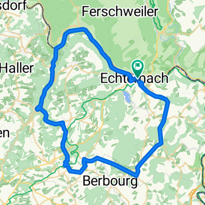
MTB - Echternach - Osweiler - Steinheim - Ferschweiler
A cycling route starting in Echternacherbrück, Rhineland-Palatinate, Germany.
Overview
About this route
A comfortable route mainly with asphalt and gravel under the wheels.
Better and clearer view in Open Cycle Map.
- -:--
- Duration
- 23.2 km
- Distance
- 452 m
- Ascent
- 452 m
- Descent
- ---
- Avg. speed
- ---
- Max. altitude

Continue with Bikemap
Use, edit, or download this cycling route
You would like to ride MTB - Echternach - Osweiler - Steinheim - Ferschweiler or customize it for your own trip? Here is what you can do with this Bikemap route:
Free features
- Save this route as favorite or in collections
- Copy & plan your own version of this route
- Sync your route with Garmin or Wahoo
Premium features
Free trial for 3 days, or one-time payment. More about Bikemap Premium.
- Navigate this route on iOS & Android
- Export a GPX / KML file of this route
- Create your custom printout (try it for free)
- Download this route for offline navigation
Discover more Premium features.
Get Bikemap PremiumFrom our community
Other popular routes starting in Echternacherbrück
 MTB - Echternach - E-See - Berdorf - Hohley
- Distance
- 18.2 km
- Ascent
- 310 m
- Descent
- 309 m
- Location
- Echternacherbrück, Rhineland-Palatinate, Germany
 Echternach - Holsthum - Echtershausen - Körperich
- Distance
- 83.9 km
- Ascent
- 1,140 m
- Descent
- 1,113 m
- Location
- Echternacherbrück, Rhineland-Palatinate, Germany
 Echternach - Prümzurlay - Ferschweiler - Weilerbach
- Distance
- 23 km
- Ascent
- 276 m
- Descent
- 276 m
- Location
- Echternacherbrück, Rhineland-Palatinate, Germany
 Rundtour in Luxemburg
- Distance
- 56.7 km
- Ascent
- 469 m
- Descent
- 457 m
- Location
- Echternacherbrück, Rhineland-Palatinate, Germany
 3Ländereck E4b Echternach-Wasserbillig
- Distance
- 27.7 km
- Ascent
- 106 m
- Descent
- 133 m
- Location
- Echternacherbrück, Rhineland-Palatinate, Germany
 Echternach - Herborn - Consdorf - Müllerthal
- Distance
- 41.9 km
- Ascent
- 623 m
- Descent
- 614 m
- Location
- Echternacherbrück, Rhineland-Palatinate, Germany
 Echternach-Beaufort-Echternach
- Distance
- 48.5 km
- Ascent
- 493 m
- Descent
- 488 m
- Location
- Echternacherbrück, Rhineland-Palatinate, Germany
 IV day
- Distance
- 164.1 km
- Ascent
- 1,471 m
- Descent
- 1,382 m
- Location
- Echternacherbrück, Rhineland-Palatinate, Germany
Open it in the app