

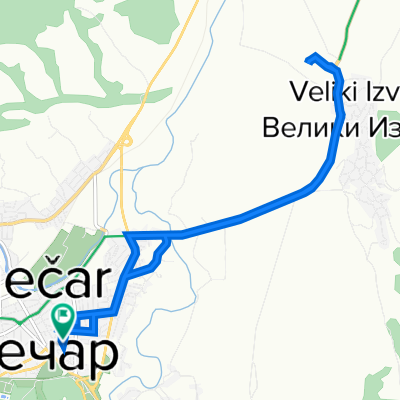
2023-12 Zaječar-Jalovik
A cycling route starting in Zaječar, Central Serbia, Serbia.
Overview
About this route
- -:--
- Duration
- 120.2 km
- Distance
- 1,762 m
- Ascent
- 1,523 m
- Descent
- ---
- Avg. speed
- 625 m
- Max. altitude

Route quality
Waytypes & surfaces along the route
Waytypes
Quiet road
6 km
(5 %)
Track
6 km
(5 %)
Surfaces
Paved
60.1 km
(50 %)
Unpaved
7.2 km
(6 %)
Asphalt
32.4 km
(27 %)
Paved (undefined)
27.6 km
(23 %)
Route highlights
Points of interest along the route
Accommodation after 0 km
H02 Zaječar
Accommodation after 87 km
H03 Jalovik/Inovo
Continue with Bikemap
Use, edit, or download this cycling route
You would like to ride 2023-12 Zaječar-Jalovik or customize it for your own trip? Here is what you can do with this Bikemap route:
Free features
- Save this route as favorite or in collections
- Copy & plan your own version of this route
- Split it into stages to create a multi-day tour
- Sync your route with Garmin or Wahoo
Premium features
Free trial for 3 days, or one-time payment. More about Bikemap Premium.
- Navigate this route on iOS & Android
- Export a GPX / KML file of this route
- Create your custom printout (try it for free)
- Download this route for offline navigation
Discover more Premium features.
Get Bikemap PremiumFrom our community
Other popular routes starting in Zaječar
 Relaxed route
- Distance
- 8.2 km
- Ascent
- 83 m
- Descent
- 111 m
- Location
- Zaječar, Central Serbia, Serbia
 2023-12 Zaječar-Pirot
- Distance
- 105.4 km
- Ascent
- 1,104 m
- Descent
- 863 m
- Location
- Zaječar, Central Serbia, Serbia
 2023-12 Zaječar-Knjaževac-Pirot
- Distance
- 104.4 km
- Ascent
- 1,032 m
- Descent
- 795 m
- Location
- Zaječar, Central Serbia, Serbia
 Sremska 11, Zaječar to Sremska 11, Zaječar
- Distance
- 13.3 km
- Ascent
- 79 m
- Descent
- 77 m
- Location
- Zaječar, Central Serbia, Serbia
 Косте Чауша 4, Зајечар to Косте Чауша 8, Зајечар
- Distance
- 2.9 km
- Ascent
- 21 m
- Descent
- 41 m
- Location
- Zaječar, Central Serbia, Serbia
 2023-D02 Zaječar-Kalna direktna
- Distance
- 66.7 km
- Ascent
- 617 m
- Descent
- 390 m
- Location
- Zaječar, Central Serbia, Serbia
 2023-12 Zaječar-Jalovik
- Distance
- 120.2 km
- Ascent
- 1,762 m
- Descent
- 1,523 m
- Location
- Zaječar, Central Serbia, Serbia
 SR24 - Day8 (Zajecar - Knjazevac) 55km / 850m
- Distance
- 54.9 km
- Ascent
- 906 m
- Descent
- 821 m
- Location
- Zaječar, Central Serbia, Serbia
Open it in the app