

tonto andy
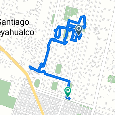
A cycling route starting in Santiago Teyahualco, State of Mexico, Mexico.
Overview
About this route
- 50 min
- Duration
- 10.7 km
- Distance
- 18 m
- Ascent
- 15 m
- Descent
- 12.9 km/h
- Avg. speed
- 2,250 m
- Max. altitude

Route quality
Waytypes & surfaces along the route
Waytypes
Quiet road
4.2 km
(39 %)
Road
2.1 km
(20 %)
Surfaces
Paved
1.8 km
(17 %)
Paved (undefined)
1.2 km
(11 %)
Asphalt
0.6 km
(6 %)
Undefined
8.9 km
(83 %)
Continue with Bikemap
Use, edit, or download this cycling route
You would like to ride tonto andy or customize it for your own trip? Here is what you can do with this Bikemap route:
Free features
- Save this route as favorite or in collections
- Copy & plan your own version of this route
- Sync your route with Garmin or Wahoo
Premium features
Free trial for 3 days, or one-time payment. More about Bikemap Premium.
- Navigate this route on iOS & Android
- Export a GPX / KML file of this route
- Create your custom printout (try it for free)
- Download this route for offline navigation
Discover more Premium features.
Get Bikemap PremiumFrom our community
Other popular routes starting in Santiago Teyahualco
 pantera
- Distance
- 6.2 km
- Ascent
- 146 m
- Descent
- 142 m
- Location
- Santiago Teyahualco, State of Mexico, Mexico
 De N. 30 B. de Pinos N. 107 2, San Francisco Coacalco a Plaza Hidalgo 2, Centro
- Distance
- 5.8 km
- Ascent
- 32 m
- Descent
- 24 m
- Location
- Santiago Teyahualco, State of Mexico, Mexico
 tonto andy
- Distance
- 10.7 km
- Ascent
- 18 m
- Descent
- 15 m
- Location
- Santiago Teyahualco, State of Mexico, Mexico
 Paseo rápido en Tultitlán de Mariano Escobedo
- Distance
- 8.9 km
- Ascent
- 71 m
- Descent
- 73 m
- Location
- Santiago Teyahualco, State of Mexico, Mexico
 De Hermanos Serdán 262, Santiago Teyahualco a Mártires de Tlatelolco 22, Santiago Teyahualco
- Distance
- 73.2 km
- Ascent
- 73 m
- Descent
- 65 m
- Location
- Santiago Teyahualco, State of Mexico, Mexico
 De Calle 5 21, Santiago Teyahualco a Calle 5 21, Santiago Teyahualco
- Distance
- 8 km
- Ascent
- 33 m
- Descent
- 30 m
- Location
- Santiago Teyahualco, State of Mexico, Mexico
 De Avenida Hacienda el Jazmín 26, Santiago Teyahualco a Avenida Felipe Carrillo Puerto 1065, Ecatepec de Morelos
- Distance
- 7.2 km
- Ascent
- 33 m
- Descent
- 30 m
- Location
- Santiago Teyahualco, State of Mexico, Mexico
 De Hacienda Real de Tultepec Oriente 199A, Santiago Teyahualco a Hacienda Real de Tultepec Oriente 203A, Santiago Teyahualco
- Distance
- 0 km
- Ascent
- 0 m
- Descent
- 0 m
- Location
- Santiago Teyahualco, State of Mexico, Mexico
Open it in the app