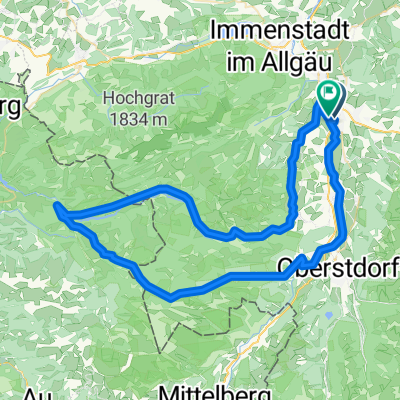
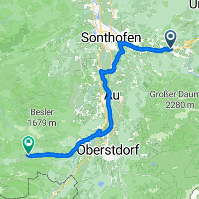
Sonthofen - Immenstadt - Untermaiselstein - Runde
A cycling route starting in Sonthofen, Bavaria, Germany.
Overview
About this route
Schöne Tour mit Start in Sonthofen auf dem Parkplatz vom Wonnemar-Bad. Von hier aus geht es an der Iller entlang auf breiten Wegen. In Immenstadt machen wir einen Abstecher zum großen Alpsee, hier gibt es im Naturpark einen Kaffee mit leckerem Kuchen.
Zurück machen wir einen Umweg über Untermaiselstein und Wagneritz. Nach Burgberg fahren wir einen großen Haken, das scheint die angenehmere Route zu sein.Von hier geht es direkt nach Sonthofen, wo wir uns im Schwimmbad belohnen.
- -:--
- Duration
- 37.5 km
- Distance
- 186 m
- Ascent
- 183 m
- Descent
- ---
- Avg. speed
- 763 m
- Max. altitude
Route photos
Route quality
Waytypes & surfaces along the route
Waytypes
Path
14.3 km
(38 %)
Quiet road
12.4 km
(33 %)
Surfaces
Paved
19.9 km
(53 %)
Unpaved
11.6 km
(31 %)
Asphalt
19.9 km
(53 %)
Gravel
10.1 km
(27 %)
Continue with Bikemap
Use, edit, or download this cycling route
You would like to ride Sonthofen - Immenstadt - Untermaiselstein - Runde or customize it for your own trip? Here is what you can do with this Bikemap route:
Free features
- Save this route as favorite or in collections
- Copy & plan your own version of this route
- Sync your route with Garmin or Wahoo
Premium features
Free trial for 3 days, or one-time payment. More about Bikemap Premium.
- Navigate this route on iOS & Android
- Export a GPX / KML file of this route
- Create your custom printout (try it for free)
- Download this route for offline navigation
Discover more Premium features.
Get Bikemap PremiumFrom our community
Other popular routes starting in Sonthofen
Richard-Wagner-Straße, Sonthofen nach Richard-Wagner-Straße, Sonthofen- Distance
- 84.6 km
- Ascent
- 2,350 m
- Descent
- 2,349 m
- Location
- Sonthofen, Bavaria, Germany
Von Hinterstein bis Bad Hindelang- Distance
- 13.9 km
- Ascent
- 709 m
- Descent
- 248 m
- Location
- Sonthofen, Bavaria, Germany
Dießen Rennrad- Distance
- 104.4 km
- Ascent
- 1,226 m
- Descent
- 1,396 m
- Location
- Sonthofen, Bavaria, Germany
Zillenbachstraße, Bad Hindelang nach Rohrmoos, Oberstdorf- Distance
- 27.7 km
- Ascent
- 633 m
- Descent
- 375 m
- Location
- Sonthofen, Bavaria, Germany
Sonthofen - Immenstadt - Untermaiselstein - Runde- Distance
- 37.5 km
- Ascent
- 186 m
- Descent
- 183 m
- Location
- Sonthofen, Bavaria, Germany
Bad Hindelang über Sonthofen nach Rubi- Distance
- 18 km
- Ascent
- 106 m
- Descent
- 142 m
- Location
- Sonthofen, Bavaria, Germany
Eichendorffstraße nach Giebelstraße- Distance
- 22.9 km
- Ascent
- 514 m
- Descent
- 188 m
- Location
- Sonthofen, Bavaria, Germany
Vom Ostrachtal zur Alp Mitterhaus (1081 m)- Distance
- 20.5 km
- Ascent
- 415 m
- Descent
- 415 m
- Location
- Sonthofen, Bavaria, Germany
Open it in the app


