
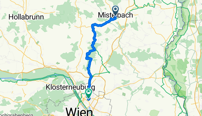
Mistelbach Bahnhof - EuroVelo9 - Kreuttal Route West - Rubensteig Waldweg - Wienblick - Wien
A cycling route starting in Mistelbach, Lower Austria, Austria.
Overview
About this route
- 3 h 48 min
- Duration
- 53.8 km
- Distance
- 533 m
- Ascent
- 573 m
- Descent
- 14.2 km/h
- Avg. speed
- 355 m
- Max. altitude
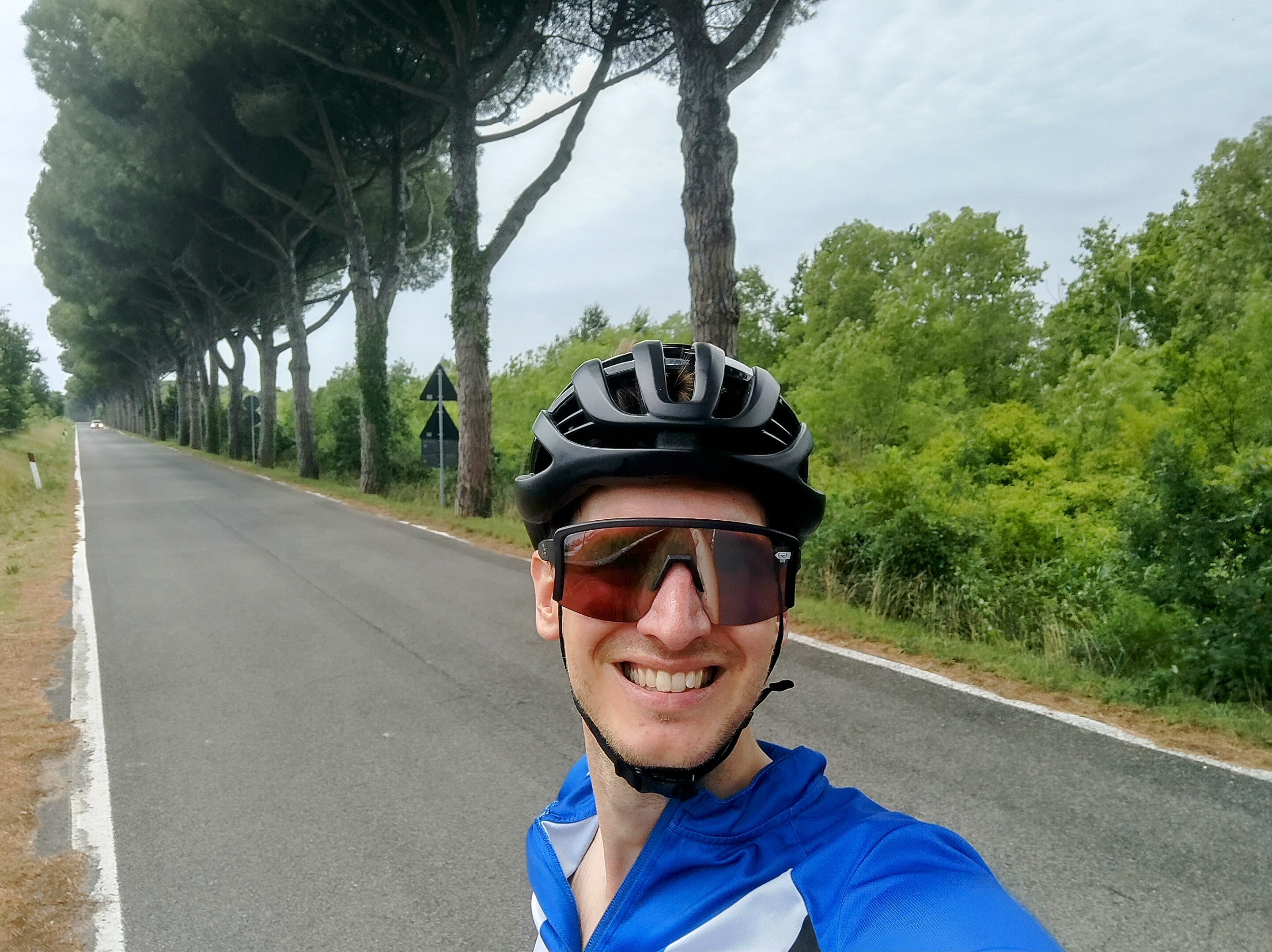
Route photos


Route quality
Waytypes & surfaces along the route
Waytypes
Quiet road
20.5 km
(38 %)
Road
14 km
(26 %)
Surfaces
Paved
39.3 km
(73 %)
Unpaved
3.2 km
(6 %)
Asphalt
37.7 km
(70 %)
Gravel
2.7 km
(5 %)
Continue with Bikemap
Use, edit, or download this cycling route
You would like to ride Mistelbach Bahnhof - EuroVelo9 - Kreuttal Route West - Rubensteig Waldweg - Wienblick - Wien or customize it for your own trip? Here is what you can do with this Bikemap route:
Free features
- Save this route as favorite or in collections
- Copy & plan your own version of this route
- Sync your route with Garmin or Wahoo
Premium features
Free trial for 3 days, or one-time payment. More about Bikemap Premium.
- Navigate this route on iOS & Android
- Export a GPX / KML file of this route
- Create your custom printout (try it for free)
- Download this route for offline navigation
Discover more Premium features.
Get Bikemap PremiumFrom our community
Other popular routes starting in Mistelbach
 Weinvierteltour
- Distance
- 44.2 km
- Ascent
- 398 m
- Descent
- 400 m
- Location
- Mistelbach, Lower Austria, Austria
 Gehen_Mistelbach
- Distance
- 3.4 km
- Ascent
- 87 m
- Descent
- 84 m
- Location
- Mistelbach, Lower Austria, Austria
 Day 8 Mistelbach - Wolkersdorf
- Distance
- 32 km
- Ascent
- 111 m
- Descent
- 141 m
- Location
- Mistelbach, Lower Austria, Austria
 After Work Runde
- Distance
- 26.3 km
- Ascent
- 122 m
- Descent
- 125 m
- Location
- Mistelbach, Lower Austria, Austria
 Lange Ausfahrt von Mistelbach nach Großrußbach
- Distance
- 31.1 km
- Ascent
- 282 m
- Descent
- 249 m
- Location
- Mistelbach, Lower Austria, Austria
 Gehen_Mistelbach
- Distance
- 9.3 km
- Ascent
- 102 m
- Descent
- 106 m
- Location
- Mistelbach, Lower Austria, Austria
 Radtour "Der Sylvaner"
- Distance
- 60.4 km
- Ascent
- 235 m
- Descent
- 237 m
- Location
- Mistelbach, Lower Austria, Austria
 IVV_2023_Mistelbach_140km_dieAnspruchsvolle_230618
- Distance
- 146.8 km
- Ascent
- 1,746 m
- Descent
- 1,745 m
- Location
- Mistelbach, Lower Austria, Austria
Open it in the app