

RheinMosel-Tour
A cycling route starting in Brodenbach, Rhineland-Palatinate, Germany.
Overview
About this route
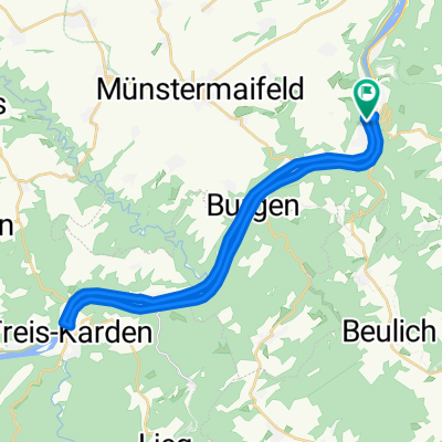
This route is intended to be a practice course for ambitious leisure cyclists. It spans 75 km with over 1100 m of elevation gain, connecting two rivers, the Rhine and the Moselle. To incorporate my home area, it goes up through the beautiful Schrumpfbachtal valley and back over the Maifeld to the Moselle. Those living by the Moselle can do a pure Moselle-Rhine tour and skip the Maifeld. Conversely, those in Maifeld who realize at the height of Ohlenfeld that the return journey is still long can go directly back to the Moselle, passing by Udenhausen. Overall, a delightful route.
- -:--
- Duration
- 75 km
- Distance
- 1,521 m
- Ascent
- 1,464 m
- Descent
- ---
- Avg. speed
- 424 m
- Max. altitude

Route quality
Waytypes & surfaces along the route
Waytypes
Road
15 km
(20 %)
Quiet road
9.8 km
(13 %)
Surfaces
Paved
48.8 km
(65 %)
Unpaved
5.3 km
(7 %)
Asphalt
48.8 km
(65 %)
Ground
2.3 km
(3 %)
Continue with Bikemap
Use, edit, or download this cycling route
You would like to ride RheinMosel-Tour or customize it for your own trip? Here is what you can do with this Bikemap route:
Free features
- Save this route as favorite or in collections
- Copy & plan your own version of this route
- Sync your route with Garmin or Wahoo
Premium features
Free trial for 3 days, or one-time payment. More about Bikemap Premium.
- Navigate this route on iOS & Android
- Export a GPX / KML file of this route
- Create your custom printout (try it for free)
- Download this route for offline navigation
Discover more Premium features.
Get Bikemap PremiumFrom our community
Other popular routes starting in Brodenbach
 Münstermaifeld über Polch+Mertloch
- Distance
- 44.4 km
- Ascent
- 424 m
- Descent
- 424 m
- Location
- Brodenbach, Rhineland-Palatinate, Germany
 12A.17-LÖF-KOBLENZ
- Distance
- 27.4 km
- Ascent
- 225 m
- Descent
- 229 m
- Location
- Brodenbach, Rhineland-Palatinate, Germany
 Moselradweg Alken-TreisKarden-Alken
- Distance
- 30.3 km
- Ascent
- 398 m
- Descent
- 400 m
- Location
- Brodenbach, Rhineland-Palatinate, Germany
 Moselufer 19, Brodenbach to Bahnhofstraße 6, Kobern-Gondorf
- Distance
- 11.3 km
- Ascent
- 181 m
- Descent
- 183 m
- Location
- Brodenbach, Rhineland-Palatinate, Germany
 Burg thurant
- Distance
- 15.2 km
- Ascent
- 347 m
- Descent
- 345 m
- Location
- Brodenbach, Rhineland-Palatinate, Germany
 Etappe 3 - FMTour2023
- Distance
- 68.3 km
- Ascent
- 365 m
- Descent
- 389 m
- Location
- Brodenbach, Rhineland-Palatinate, Germany
 RheinMosel-Tour
- Distance
- 75 km
- Ascent
- 1,521 m
- Descent
- 1,464 m
- Location
- Brodenbach, Rhineland-Palatinate, Germany
 Löf - Trier
- Distance
- 153.7 km
- Ascent
- 528 m
- Descent
- 471 m
- Location
- Brodenbach, Rhineland-Palatinate, Germany
Open it in the app