

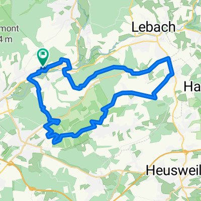
Diefflen-Berglicht-Gräfendhorn
A cycling route starting in Nalbach, Saarland, Germany.
Overview
About this route
The route is very easy to ride. Little traffic on the roads to be taken.
- -:--
- Duration
- 89.9 km
- Distance
- 1,211 m
- Ascent
- 1,170 m
- Descent
- ---
- Avg. speed
- 791 m
- Max. altitude
Route quality
Waytypes & surfaces along the route
Waytypes
Path
17.1 km
(19 %)
Quiet road
13.5 km
(15 %)
Surfaces
Paved
74.6 km
(83 %)
Unpaved
7.2 km
(8 %)
Asphalt
65.6 km
(73 %)
Paved (undefined)
8.1 km
(9 %)
Continue with Bikemap
Use, edit, or download this cycling route
You would like to ride Diefflen-Berglicht-Gräfendhorn or customize it for your own trip? Here is what you can do with this Bikemap route:
Free features
- Save this route as favorite or in collections
- Copy & plan your own version of this route
- Split it into stages to create a multi-day tour
- Sync your route with Garmin or Wahoo
Premium features
Free trial for 3 days, or one-time payment. More about Bikemap Premium.
- Navigate this route on iOS & Android
- Export a GPX / KML file of this route
- Create your custom printout (try it for free)
- Download this route for offline navigation
Discover more Premium features.
Get Bikemap PremiumFrom our community
Other popular routes starting in Nalbach
 Über die Höhen des Saarlandes 2007 - RTF der Radsportfreunde Körprich e.V. - 46 km Strecke
- Distance
- 49.7 km
- Ascent
- 285 m
- Descent
- 285 m
- Location
- Nalbach, Saarland, Germany
 Über die Höhen des Saarlandes 2011 - RTF der Radsportfreunde Körprich e.V. - 151 km Strecke
- Distance
- 150.9 km
- Ascent
- 1,699 m
- Descent
- 1,587 m
- Location
- Nalbach, Saarland, Germany
 Nordsaarlandfahrt - RTF der Radsportfreunde Körprich e.V. - 74 km Strecke
- Distance
- 77.6 km
- Ascent
- 881 m
- Descent
- 880 m
- Location
- Nalbach, Saarland, Germany
 Über die Höhen des Saarlandes 2007 - RTF der Radsportfreunde Körprich e.V. - 76 km Strecke
- Distance
- 78.2 km
- Ascent
- 611 m
- Descent
- 612 m
- Location
- Nalbach, Saarland, Germany
 Hoxberg und teilweise Schluchtenpfad
- Distance
- 30.1 km
- Ascent
- 405 m
- Descent
- 405 m
- Location
- Nalbach, Saarland, Germany
 Düppenweiler - Hüttersdorf 13.05.2022
- Distance
- 23.7 km
- Ascent
- 530 m
- Descent
- 530 m
- Location
- Nalbach, Saarland, Germany
 Rund um Weltersberg
- Distance
- 20.8 km
- Ascent
- 482 m
- Descent
- 481 m
- Location
- Nalbach, Saarland, Germany
 Schnelle Powerroute
- Distance
- 11.7 km
- Ascent
- 307 m
- Descent
- 307 m
- Location
- Nalbach, Saarland, Germany
Open it in the app