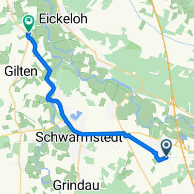
Buchholz(Aller)-Ludwigslust-Parchim-269km
A cycling route starting in Essel, Lower Saxony, Germany.
Overview
About this route
- -:--
- Duration
- 268.4 km
- Distance
- 1,265 m
- Ascent
- 1,245 m
- Descent
- ---
- Avg. speed
- 141 m
- Max. altitude
Route quality
Waytypes & surfaces along the route
Waytypes
Quiet road
78.7 km
(29 %)
Path
60.1 km
(22 %)
Surfaces
Paved
166.4 km
(62 %)
Unpaved
30.9 km
(12 %)
Asphalt
129.8 km
(48 %)
Paving stones
20.9 km
(8 %)
Route highlights
Points of interest along the route
Point of interest after 0.4 km
Buchholz (Aller)
Point of interest after 2.5 km
A7
Point of interest after 16 km
Hornbostel
Point of interest after 22 km
Winsen (Aller)
Point of interest after 40.1 km
Schloss Celle
Point of interest after 40.6 km
Celle
Point of interest after 40.9 km
Pfennigbrücke, Fußgänger- u. Radfahrerbrücke. Die Pfennigbrücke wurde zur Zeit des Deutschen Kaiserreichs erstmals im Jahr 1900 errichtet als privat betriebene Holzbrücke über die Aller. Passanten mussten anfangs einen Pfennig Brückenzoll entrichten, später den doppelten Betrag, wie sich auch der Schriftsteller Hans Fallada erinnerte.[
Point of interest after 45.3 km
Bostel
Point of interest after 59.4 km
Eschede
Point of interest after 81.7 km
Breitenhees
Point of interest after 89.5 km
Holdenstedt
Point of interest after 95 km
Uelzen
Point of interest after 98.2 km
Elbe-Seitenkanal
Point of interest after 110.4 km
Bad Bevensen
Point of interest after 129.2 km
Dahlenburg
Point of interest after 148.4 km
Neu Darchau an der Elbe
Point of interest after 163.7 km
Hitzacker (Elbe)
Point of interest after 187.3 km
Dömitz
Point of interest after 227.2 km
Ludwigslust
Point of interest after 230 km
A14
Point of interest after 239.1 km
Neustadt-Glewe
Point of interest after 245.4 km
Karpfenteiche
Point of interest after 267.8 km
Parchim
Continue with Bikemap
Use, edit, or download this cycling route
You would like to ride Buchholz(Aller)-Ludwigslust-Parchim-269km or customize it for your own trip? Here is what you can do with this Bikemap route:
Free features
- Save this route as favorite or in collections
- Copy & plan your own version of this route
- Split it into stages to create a multi-day tour
- Sync your route with Garmin or Wahoo
Premium features
Free trial for 3 days, or one-time payment. More about Bikemap Premium.
- Navigate this route on iOS & Android
- Export a GPX / KML file of this route
- Create your custom printout (try it for free)
- Download this route for offline navigation
Discover more Premium features.
Get Bikemap PremiumFrom our community
Other popular routes starting in Essel
 Route1
- Distance
- 11.7 km
- Ascent
- 4 m
- Descent
- 8 m
- Location
- Essel, Lower Saxony, Germany
 Buchholz(Aller)-Plau-250km
- Distance
- 506.8 km
- Ascent
- 1,832 m
- Descent
- 1,857 m
- Location
- Essel, Lower Saxony, Germany
 Aller Buchholz Rethem
- Distance
- 60.9 km
- Ascent
- 49 m
- Descent
- 42 m
- Location
- Essel, Lower Saxony, Germany
 Schnelle Radrunde durch Schwarmstedt
- Distance
- 3.5 km
- Ascent
- 9 m
- Descent
- 8 m
- Location
- Essel, Lower Saxony, Germany
 Durch das Aller - Leine Tal
- Distance
- 67.6 km
- Ascent
- 138 m
- Descent
- 134 m
- Location
- Essel, Lower Saxony, Germany
 Saale 14b: Buchholz - Achim, Bootshaus, 78km, 44hm
- Distance
- 78.4 km
- Ascent
- 44 m
- Descent
- 62 m
- Location
- Essel, Lower Saxony, Germany
 Hannoversche Straße 2, Essel nach Eschenweg 35, Essel
- Distance
- 16.4 km
- Ascent
- 6 m
- Descent
- 11 m
- Location
- Essel, Lower Saxony, Germany
 Haselkampweg 6, Buchholz (Aller) nach Meierweg 11A, Buchholz (Aller)
- Distance
- 14 km
- Ascent
- 80 m
- Descent
- 83 m
- Location
- Essel, Lower Saxony, Germany
Open it in the app


