

渥美半島コース
A cycling route starting in Toyohashi, Aichi, Japan.
Overview
About this route
null
- -:--
- Duration
- 101.5 km
- Distance
- 903 m
- Ascent
- 901 m
- Descent
- ---
- Avg. speed
- 237 m
- Max. altitude

Continue with Bikemap
Use, edit, or download this cycling route
You would like to ride 渥美半島コース or customize it for your own trip? Here is what you can do with this Bikemap route:
Free features
- Save this route as favorite or in collections
- Copy & plan your own version of this route
- Split it into stages to create a multi-day tour
- Sync your route with Garmin or Wahoo
Premium features
Free trial for 3 days, or one-time payment. More about Bikemap Premium.
- Navigate this route on iOS & Android
- Export a GPX / KML file of this route
- Create your custom printout (try it for free)
- Download this route for offline navigation
Discover more Premium features.
Get Bikemap PremiumFrom our community
Other popular routes starting in Toyohashi
 竹島水族館行き
- Distance
- 18 km
- Ascent
- 145 m
- Descent
- 146 m
- Location
- Toyohashi, Aichi, Japan
 Toyohashi to Ise-jingu Grand Shrine
- Distance
- 81.2 km
- Ascent
- 286 m
- Descent
- 271 m
- Location
- Toyohashi, Aichi, Japan
 豊橋〜岐阜
豊橋〜岐阜- Distance
- 104.2 km
- Ascent
- 338 m
- Descent
- 365 m
- Location
- Toyohashi, Aichi, Japan
 Moderate route in Toyohashi-Shi
- Distance
- 48.6 km
- Ascent
- 1,028 m
- Descent
- 1,024 m
- Location
- Toyohashi, Aichi, Japan
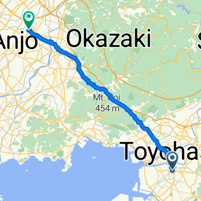 Toyohashi - Anjo
- Distance
- 44.1 km
- Ascent
- 265 m
- Descent
- 261 m
- Location
- Toyohashi, Aichi, Japan
 旧東海道自転車の旅~Day 5
- Distance
- 90.7 km
- Ascent
- 202 m
- Descent
- 200 m
- Location
- Toyohashi, Aichi, Japan
 豊橋市〜大垣市
- Distance
- 110.7 km
- Ascent
- 509 m
- Descent
- 514 m
- Location
- Toyohashi, Aichi, Japan
 道の駅とよはし-渥美半島一周
- Distance
- 98.4 km
- Ascent
- 519 m
- Descent
- 516 m
- Location
- Toyohashi, Aichi, Japan
Open it in the app