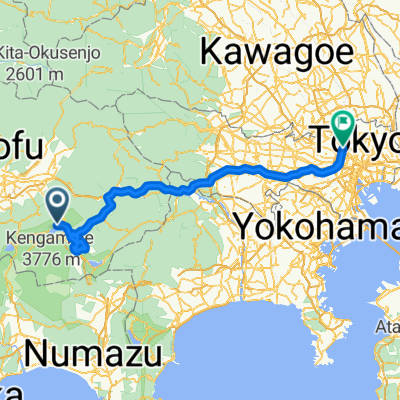
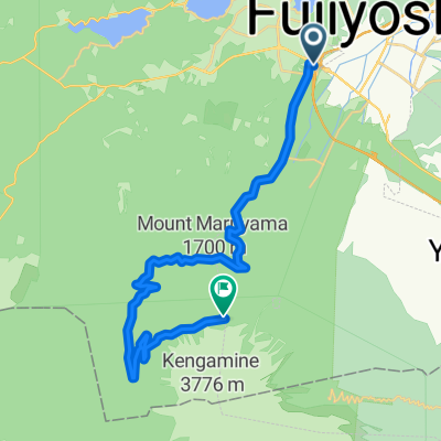
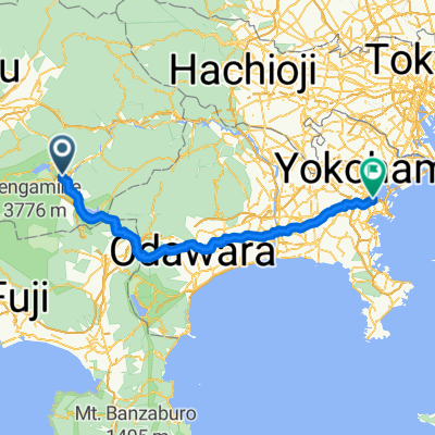
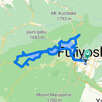
MYSTAYS 富士山展望温泉酒店 to Fujiyoshida
- 103.6 km
- 2,488 m
- 2,488 m
- Fujikawaguchiko, Yamanashi, Japan
A cycling route starting in Fujikawaguchiko, Yamanashi, Japan.
Overview
Altitude: 1011 meters - Altitude: 2301 meters - Distance from statistical data calculated from imported data: 25.5 kilometers. Minimum altitude: 1008 meters, maximum altitude: 2306 meters, total ascent: 1338 meters, total descent: 45 meters.
created this 2 years ago
Route quality
Road
0.5 km
(2 %)
Access road
0.3 km
(1 %)
Undefined
24.7 km
(97 %)
Paved
6.4 km
(25 %)
Asphalt
6.4 km
(25 %)
Undefined
19.1 km
(75 %)
Continue with Bikemap
You would like to ride 「Day 3 北進富士山」的起點 - Day 3 北進富士山終點 - Day 3 北進富士山 or customize it for your own trip? Here is what you can do with this Bikemap route:
Free trial for 3 days, or one-time payment. More about Bikemap Premium.
Discover more Premium features.
Get Bikemap PremiumFrom our community
Open it in the app