

Mooloolaba to Mt Coolum
A cycling route starting in Mooloolabah, Queensland, Australia.
Overview
About this route
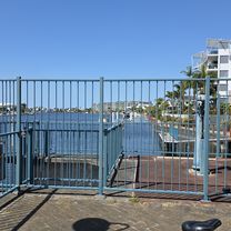
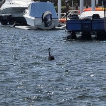
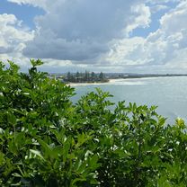
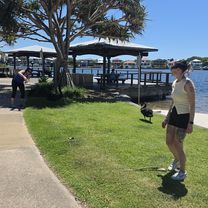
e-bike ride from Mooloolaba to Mt Coolum as we approached Mt Coolum, the road turnes inland towards Mount Coolum National Park. Even though we left the Coastal Pathway at Tanah St West (there were traffic lights with a pedestrian crossing that helped us negotiate the David Low Way), the path was still excellent all the way to the carpark at the bottom of the mountain. The e-bikes’ electric-assist made it easy for everyone to tackle the 23km ride, leaving us fresh for our climb to the summit of Mt Coolum. The top of this volcanic dome gave us panoramic views of the surrounding area, including the ocean, the hinterland, and the Glass House Mountains. Stunning!
- -:--
- Duration
- 52.4 km
- Distance
- 187 m
- Ascent
- 187 m
- Descent
- ---
- Avg. speed
- 34 m
- Max. altitude

Route quality
Waytypes & surfaces along the route
Waytypes
Cycleway
44 km
(84 %)
Quiet road
4.2 km
(8 %)
Surfaces
Paved
46.7 km
(89 %)
Concrete
38.3 km
(73 %)
Asphalt
4.7 km
(9 %)
Continue with Bikemap
Use, edit, or download this cycling route
You would like to ride Mooloolaba to Mt Coolum or customize it for your own trip? Here is what you can do with this Bikemap route:
Free features
- Save this route as favorite or in collections
- Copy & plan your own version of this route
- Sync your route with Garmin or Wahoo
Premium features
Free trial for 3 days, or one-time payment. More about Bikemap Premium.
- Navigate this route on iOS & Android
- Export a GPX / KML file of this route
- Create your custom printout (try it for free)
- Download this route for offline navigation
Discover more Premium features.
Get Bikemap PremiumFrom our community
Other popular routes starting in Mooloolabah
 Harbour Parade to Harbour Parade
- Distance
- 42.7 km
- Ascent
- 100 m
- Descent
- 147 m
- Location
- Mooloolabah, Queensland, Australia
 La Balsa Park, Buddina to Happy Valley, Caloundra
- Distance
- 44.2 km
- Ascent
- 188 m
- Descent
- 190 m
- Location
- Mooloolabah, Queensland, Australia
 Harbour Parade to Harbour Parade
- Distance
- 42.5 km
- Ascent
- 120 m
- Descent
- 171 m
- Location
- Mooloolabah, Queensland, Australia
 Mooloolaba to Moffat Beach
- Distance
- 46.5 km
- Ascent
- 49 m
- Descent
- 50 m
- Location
- Mooloolabah, Queensland, Australia
 Harbour Parade to Harbour Parade
- Distance
- 41.2 km
- Ascent
- 171 m
- Descent
- 217 m
- Location
- Mooloolabah, Queensland, Australia
 Harbour Parade to Harbour Parade
- Distance
- 41.3 km
- Ascent
- 140 m
- Descent
- 190 m
- Location
- Mooloolabah, Queensland, Australia
 River to River, e-Bike Tour
- Distance
- 15.8 km
- Ascent
- 72 m
- Descent
- 74 m
- Location
- Mooloolabah, Queensland, Australia
 Mooloolaba, Mooloolah River, Pt Cartwright Circuit
- Distance
- 27.4 km
- Ascent
- 66 m
- Descent
- 66 m
- Location
- Mooloolabah, Queensland, Australia
Open it in the app