
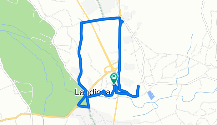
Rua da Landiosa 47, Aguada de Baixo to Rua da Landiosa 47, Aguada de Baixo
A cycling route starting in Aguada de Cima, Aveiro District, Portugal.
Overview
About this route
- 27 min
- Duration
- 6 km
- Distance
- 41 m
- Ascent
- 44 m
- Descent
- 13.2 km/h
- Avg. speed
- 47 m
- Avg. speed

Route quality
Waytypes & surfaces along the route
Waytypes
Quiet road
3.2 km
(53 %)
Busy road
1.7 km
(29 %)
Surfaces
Paved
3.4 km
(56 %)
Asphalt
2.9 km
(49 %)
Paved (undefined)
0.4 km
(7 %)
Undefined
2.6 km
(44 %)
Continue with Bikemap
Use, edit, or download this cycling route
You would like to ride Rua da Landiosa 47, Aguada de Baixo to Rua da Landiosa 47, Aguada de Baixo or customize it for your own trip? Here is what you can do with this Bikemap route:
Free features
- Save this route as favorite or in collections
- Copy & plan your own version of this route
- Sync your route with Garmin or Wahoo
Premium features
Free trial for 3 days, or one-time payment. More about Bikemap Premium.
- Navigate this route on iOS & Android
- Export a GPX / KML file of this route
- Create your custom printout (try it for free)
- Download this route for offline navigation
Discover more Premium features.
Get Bikemap PremiumFrom our community
Other popular routes starting in Aguada de Cima
 Relaxed route in Águeda
- Distance
- 4.9 km
- Ascent
- 51 m
- Descent
- 35 m
- Location
- Aguada de Cima, Aveiro District, Portugal
 Casa Talhadas
- Distance
- 34 km
- Ascent
- 767 m
- Descent
- 488 m
- Location
- Aguada de Cima, Aveiro District, Portugal
 Casa Luso
- Distance
- 20.1 km
- Ascent
- 576 m
- Descent
- 511 m
- Location
- Aguada de Cima, Aveiro District, Portugal
 Meia LAAC
- Distance
- 26.7 km
- Ascent
- 603 m
- Descent
- 527 m
- Location
- Aguada de Cima, Aveiro District, Portugal
 AgCima Boialvo pelo Repolão
- Distance
- 32.5 km
- Ascent
- 279 m
- Descent
- 279 m
- Location
- Aguada de Cima, Aveiro District, Portugal
 Vagueira-Mira
- Distance
- 95.7 km
- Ascent
- 273 m
- Descent
- 266 m
- Location
- Aguada de Cima, Aveiro District, Portugal
 Belazaima,Caramulinho,Belazaima-Oficial
- Distance
- 44.8 km
- Ascent
- 1,100 m
- Descent
- 1,101 m
- Location
- Aguada de Cima, Aveiro District, Portugal
 Praias - Barra/Costa/Vagueira
- Distance
- 78.6 km
- Ascent
- 378 m
- Descent
- 371 m
- Location
- Aguada de Cima, Aveiro District, Portugal
Open it in the app