

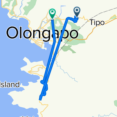
40 km ride SRF to SRF Subic Olongapo
A cycling route starting in Olongapo City, Central Luzon, Philippines.
Overview
About this route
- -:--
- Duration
- 40.7 km
- Distance
- 466 m
- Ascent
- 464 m
- Descent
- ---
- Avg. speed
- 147 m
- Max. altitude

Route quality
Waytypes & surfaces along the route
Waytypes
Road
18.3 km
(45 %)
Quiet road
7.3 km
(18 %)
Surfaces
Paved
17.9 km
(44 %)
Asphalt
16.3 km
(40 %)
Concrete
1.6 km
(4 %)
Undefined
22.8 km
(56 %)
Route highlights
Points of interest along the route
Point of interest after 40.5 km
STARTING POINT
Continue with Bikemap
Use, edit, or download this cycling route
You would like to ride 40 km ride SRF to SRF Subic Olongapo or customize it for your own trip? Here is what you can do with this Bikemap route:
Free features
- Save this route as favorite or in collections
- Copy & plan your own version of this route
- Sync your route with Garmin or Wahoo
Premium features
Free trial for 3 days, or one-time payment. More about Bikemap Premium.
- Navigate this route on iOS & Android
- Export a GPX / KML file of this route
- Create your custom printout (try it for free)
- Download this route for offline navigation
Discover more Premium features.
Get Bikemap PremiumFrom our community
Other popular routes starting in Olongapo City
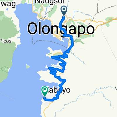
 Juan Luna Street 771, Olongapo to Jose Abad Santos Avenue 2798, Olongapo
- Distance
- 26 km
- Ascent
- 120 m
- Descent
- 232 m
- Location
- Olongapo City, Central Luzon, Philippines
 40 km ride SRF to SRF Subic Olongapo
- Distance
- 40.7 km
- Ascent
- 466 m
- Descent
- 464 m
- Location
- Olongapo City, Central Luzon, Philippines
 Boton Junction, Morong to Gladiola Street 27a, Olongapo
- Distance
- 6 km
- Ascent
- 29 m
- Descent
- 14 m
- Location
- Olongapo City, Central Luzon, Philippines
 on road to bike
- Distance
- 0.3 km
- Ascent
- 16 m
- Descent
- 4 m
- Location
- Olongapo City, Central Luzon, Philippines
 Route to Fendler Street, Olongapo City
- Distance
- 13 km
- Ascent
- 43 m
- Descent
- 40 m
- Location
- Olongapo City, Central Luzon, Philippines
 From Olongapo City to Morong
- Distance
- 41.1 km
- Ascent
- 960 m
- Descent
- 942 m
- Location
- Olongapo City, Central Luzon, Philippines
 Naval Air Station Cubi Point, Subic Bay Freeport Zone to Olongapo - Bugallon Road 14
- Distance
- 10.8 km
- Ascent
- 220 m
- Descent
- 146 m
- Location
- Olongapo City, Central Luzon, Philippines
 Dinalupihan to Dinalupihan
- Distance
- 88.5 km
- Ascent
- 694 m
- Descent
- 694 m
- Location
- Olongapo City, Central Luzon, Philippines
Open it in the app