

Albertville - La Toussuire
A cycling route starting in Albertville, Auvergne-Rhône-Alpes, France.
Overview
About this route
Eine sehr schwere Strecke. Es geht über den Cormet de Roseland, den Montée d'Hautville, den Col de l'Iseran, mit seinen über 2700 m und den Schlussanstieg hinauf nach La Toussuire. Es stehen also 4 Hochgebirgsanstiege auf dem Programm, wovon einer über 2000 m führt und ein anderer an dieser Grenze kratzt. Zudem ist die Strecke auch noch ca. 220 km lang und somit kommt die Ermüdung auch noch hinzu.
- -:--
- Duration
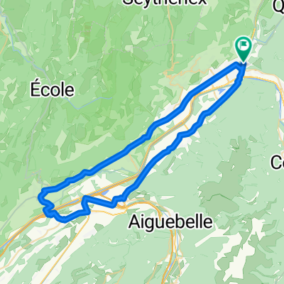
- 221.8 km
- Distance
- 5,039 m
- Ascent
- 3,678 m
- Descent
- ---
- Avg. speed
- ---
- Max. altitude
Continue with Bikemap
Use, edit, or download this cycling route
You would like to ride Albertville - La Toussuire or customize it for your own trip? Here is what you can do with this Bikemap route:
Free features
- Save this route as favorite or in collections
- Copy & plan your own version of this route
- Split it into stages to create a multi-day tour
- Sync your route with Garmin or Wahoo
Premium features
Free trial for 3 days, or one-time payment. More about Bikemap Premium.
- Navigate this route on iOS & Android
- Export a GPX / KML file of this route
- Create your custom printout (try it for free)
- Download this route for offline navigation
Discover more Premium features.
Get Bikemap PremiumFrom our community
Other popular routes starting in Albertville
 Tour de France 2016 - Stage 19
- Distance
- 154.5 km
- Ascent
- 3,656 m
- Descent
- 2,625 m
- Location
- Albertville, Auvergne-Rhône-Alpes, France
 09-D. Albertville - Roche Béranger (151,2 Km)
- Distance
- 151.2 km
- Ascent
- 4,491 m
- Descent
- 3,035 m
- Location
- Albertville, Auvergne-Rhône-Alpes, France
 D'ALBERTVILLE A ANNECY 50KMS ENVIRON
- Distance
- 46.5 km
- Ascent
- 199 m
- Descent
- 86 m
- Location
- Albertville, Auvergne-Rhône-Alpes, France
 La Combe de Savoie // Albertville - St Pierre d'Albigny
- Distance
- 54.4 km
- Ascent
- 435 m
- Descent
- 435 m
- Location
- Albertville, Auvergne-Rhône-Alpes, France
 albertville - colle delle finestre (italy)
- Distance
- 197.2 km
- Ascent
- 4,734 m
- Descent
- 3,088 m
- Location
- Albertville, Auvergne-Rhône-Alpes, France
 2018-06-16 / Col de Montessuit + Col du Pré + Cormet de Roselend + Lac de la Gittaz
- Distance
- 88.4 km
- Ascent
- 2,021 m
- Descent
- 2,020 m
- Location
- Albertville, Auvergne-Rhône-Alpes, France
 Rhone-Alpes: Etappe 2
- Distance
- 75.1 km
- Ascent
- 1,903 m
- Descent
- 1,673 m
- Location
- Albertville, Auvergne-Rhône-Alpes, France
 Cormet de Roselend
- Distance
- 77.9 km
- Ascent
- 2,870 m
- Descent
- 2,390 m
- Location
- Albertville, Auvergne-Rhône-Alpes, France
Open it in the app