
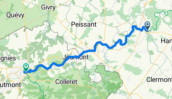
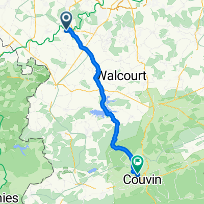
Overview
About this route
- -:--
- Duration
- 33.6 km
- Distance
- 151 m
- Ascent
- 135 m
- Descent
- ---
- Avg. speed
- 135 m
- Max. altitude

Part of
Ratingen-Maubeuge
8 stages
Route quality
Waytypes & surfaces along the route
Waytypes
Cycleway
13.8 km
(41 %)
Path
12.1 km
(36 %)
Surfaces
Paved
20.8 km
(62 %)
Unpaved
0.7 km
(2 %)
Asphalt
10.8 km
(32 %)
Concrete
10.1 km
(30 %)
Continue with Bikemap
Use, edit, or download this cycling route
You would like to ride 08_EV3_Thuin_Maubeuge or customize it for your own trip? Here is what you can do with this Bikemap route:
Free features
- Save this route as favorite or in collections
- Copy & plan your own version of this route
- Sync your route with Garmin or Wahoo
Premium features
Free trial for 3 days, or one-time payment. More about Bikemap Premium.
- Navigate this route on iOS & Android
- Export a GPX / KML file of this route
- Create your custom printout (try it for free)
- Download this route for offline navigation
Discover more Premium features.
Get Bikemap PremiumFrom our community
Other popular routes starting in Thuin
 ADA 8km
- Distance
- 8 km
- Ascent
- 194 m
- Descent
- 197 m
- Location
- Thuin, Wallonia, Belgium
 Thuin - Namur
- Distance
- 59.3 km
- Ascent
- 207 m
- Descent
- 261 m
- Location
- Thuin, Wallonia, Belgium
 Stadswandeling Thuin
- Distance
- 4.4 km
- Ascent
- 139 m
- Descent
- 144 m
- Location
- Thuin, Wallonia, Belgium
 Plan bis
- Distance
- 41.7 km
- Ascent
- 370 m
- Descent
- 335 m
- Location
- Thuin, Wallonia, Belgium
 VTT Sept pêchés capitaux - Thuin
- Distance
- 79.3 km
- Ascent
- 1,364 m
- Descent
- 1,366 m
- Location
- Thuin, Wallonia, Belgium
 Long Dimanche Course In Ham-Sur-Heure-Nalinnes
- Distance
- 17.7 km
- Ascent
- 374 m
- Descent
- 381 m
- Location
- Thuin, Wallonia, Belgium
 Try Thuin-St Quentin
- Distance
- 135.8 km
- Ascent
- 403 m
- Descent
- 407 m
- Location
- Thuin, Wallonia, Belgium
 Ragnies- Parcours d'exploration au coeur de la Thudinie
- Distance
- 34.6 km
- Ascent
- 177 m
- Descent
- 179 m
- Location
- Thuin, Wallonia, Belgium
Open it in the app