

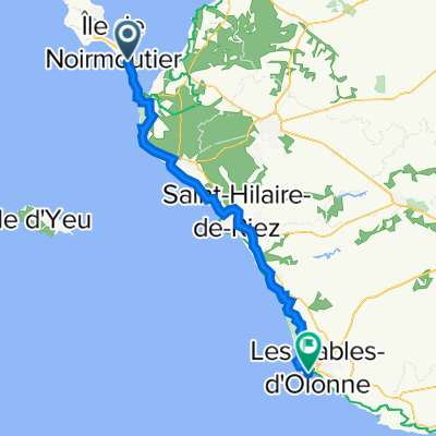
noirmoutier/saint-gilles-de-croix (les cypres)
A cycling route starting in Barbâtre, Pays de la Loire Region, France.
Overview
About this route
- -:--
- Duration
- 48.5 km
- Distance
- 119 m
- Ascent
- 120 m
- Descent
- ---
- Avg. speed
- 17 m
- Avg. speed
Route quality
Waytypes & surfaces along the route
Waytypes
Cycleway
16.1 km
(33 %)
Quiet road
15.4 km
(32 %)
Surfaces
Paved
21.7 km
(45 %)
Unpaved
15.8 km
(33 %)
Asphalt
20.6 km
(43 %)
Gravel
13.9 km
(29 %)
Route highlights
Points of interest along the route
Point of interest after 29.9 km
les salines
Point of interest after 44.7 km
la marzelle
Continue with Bikemap
Use, edit, or download this cycling route
You would like to ride noirmoutier/saint-gilles-de-croix (les cypres) or customize it for your own trip? Here is what you can do with this Bikemap route:
Free features
- Save this route as favorite or in collections
- Copy & plan your own version of this route
- Sync your route with Garmin or Wahoo
Premium features
Free trial for 3 days, or one-time payment. More about Bikemap Premium.
- Navigate this route on iOS & Android
- Export a GPX / KML file of this route
- Create your custom printout (try it for free)
- Download this route for offline navigation
Discover more Premium features.
Get Bikemap PremiumFrom our community
Other popular routes starting in Barbâtre
 noirmoutier/saint-gilles-de-croix (les cypres)
- Distance
- 48.5 km
- Ascent
- 119 m
- Descent
- 120 m
- Location
- Barbâtre, Pays de la Loire Region, France
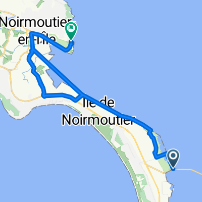
 De 141 Route du Gois, Barbâtre à 5 Place de l'Église, La Guérinière
- Distance
- 8.8 km
- Ascent
- 0 m
- Descent
- 3 m
- Location
- Barbâtre, Pays de la Loire Region, France
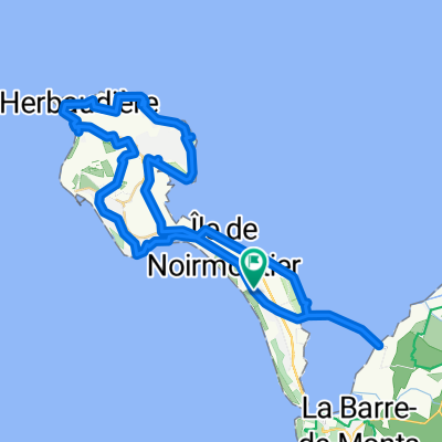
 De Impasse du François 8, Barbâtre à Impasse du François 8, Barbâtre
- Distance
- 25.7 km
- Ascent
- 4 m
- Descent
- 6 m
- Location
- Barbâtre, Pays de la Loire Region, France
 Chemin du Grand Cloudy 28, Barbâtre nach Rue du Roi Albert 1er 10, Les Sables-d'Olonne
- Distance
- 75.5 km
- Ascent
- 870 m
- Descent
- 860 m
- Location
- Barbâtre, Pays de la Loire Region, France
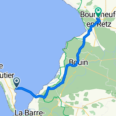
 Route du Gois, Barbâtre to Chemin du Fort Larron, Noirmoutier-en-l'Île
- Distance
- 25.8 km
- Ascent
- 26 m
- Descent
- 27 m
- Location
- Barbâtre, Pays de la Loire Region, France
 Route du Gois, Barbâtre à Rue du Bonhomme, La Guérinière
- Distance
- 7.7 km
- Ascent
- 3 m
- Descent
- 6 m
- Location
- Barbâtre, Pays de la Loire Region, France
 bourg neuf
- Distance
- 26.7 km
- Ascent
- 5 m
- Descent
- 0 m
- Location
- Barbâtre, Pays de la Loire Region, France
 NOIRMOUTIER 2015.06.17
- Distance
- 60 km
- Ascent
- 26 m
- Descent
- 25 m
- Location
- Barbâtre, Pays de la Loire Region, France
Open it in the app