

Short/Recovery Training Route
A cycling route starting in Mount Clear, Victoria, Australia.
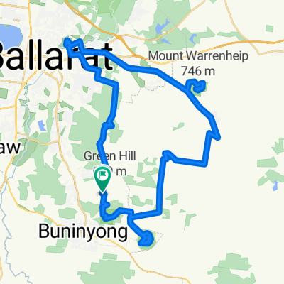
Overview
About this route
This is the flattest cycling route and used for recovery rides, or rehab rides from injury.
It just drops the National Road course from the normal training ride which removes the climb up Mt Buninyong and drops the cycling time to just over an hour which is good when time for a ride is limited.
- -:--
- Duration
- 35 km
- Distance
- 224 m
- Ascent
- 224 m
- Descent
- ---
- Avg. speed
- ---
- Max. altitude
Continue with Bikemap
Use, edit, or download this cycling route
You would like to ride Short/Recovery Training Route or customize it for your own trip? Here is what you can do with this Bikemap route:
Free features
- Save this route as favorite or in collections
- Copy & plan your own version of this route
- Sync your route with Garmin or Wahoo
Premium features
Free trial for 3 days, or one-time payment. More about Bikemap Premium.
- Navigate this route on iOS & Android
- Export a GPX / KML file of this route
- Create your custom printout (try it for free)
- Download this route for offline navigation
Discover more Premium features.
Get Bikemap PremiumFrom our community
Other popular routes starting in Mount Clear
 Buninyong Loop via Gong Gong
- Distance
- 23.1 km
- Ascent
- 246 m
- Descent
- 189 m
- Location
- Mount Clear, Victoria, Australia
![[National Championships Australia (Buninyong) I.T.T. 2010]](https://media.bikemap.net/routes/321409/staticmaps/in_0263a71d-a025-447c-9456-935ffa540f64_400x400_bikemap-2021-3D-static.png) [National Championships Australia (Buninyong) I.T.T. 2010]
[National Championships Australia (Buninyong) I.T.T. 2010]- Distance
- 39 km
- Ascent
- 323 m
- Descent
- 258 m
- Location
- Mount Clear, Victoria, Australia
 The Ballarat "Triple Crown"
- Distance
- 50.2 km
- Ascent
- 680 m
- Descent
- 680 m
- Location
- Mount Clear, Victoria, Australia
 Ballarat 1
- Distance
- 13.1 km
- Ascent
- 220 m
- Descent
- 169 m
- Location
- Mount Clear, Victoria, Australia
 Lal Falls LONG Gravel Loop
- Distance
- 68.4 km
- Ascent
- 410 m
- Descent
- 410 m
- Location
- Mount Clear, Victoria, Australia
![[National Championships Australia (Buninyong) R.R. 2010]](https://media.bikemap.net/routes/321411/staticmaps/in_c57d7ca7-4e02-439c-b259-c1b3a101bb2c_400x400_bikemap-2021-3D-static.png) [National Championships Australia (Buninyong) R.R. 2010]
[National Championships Australia (Buninyong) R.R. 2010]- Distance
- 10.2 km
- Ascent
- 179 m
- Descent
- 182 m
- Location
- Mount Clear, Victoria, Australia
 Buninyong to Ballarat via museums and memorials
- Distance
- 27.6 km
- Ascent
- 321 m
- Descent
- 623 m
- Location
- Mount Clear, Victoria, Australia
 AUSTRALIAN ELITE ROAD CHAMPS
- Distance
- 10.1 km
- Ascent
- 183 m
- Descent
- 186 m
- Location
- Mount Clear, Victoria, Australia
Open it in the app