

Geisling-Schw.Gmünd
A cycling route starting in Schwäbisch Gmünd, Baden-Wurttemberg, Germany.
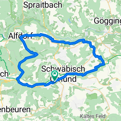
Overview
About this route
Start at Geislingen station or from Westerstetten +20km
In Unterbettringen EDEKA (about 3km later water)
In Ottenbach cemetery ( water )
- 5 h 12 min
- Duration
- 73.1 km
- Distance
- 1,580 m
- Ascent
- 1,584 m
- Descent
- 14.1 km/h
- Avg. speed
- 689 m
- Max. altitude
Route quality
Waytypes & surfaces along the route
Waytypes
Road
24.1 km
(33 %)
Quiet road
16.8 km
(23 %)
Surfaces
Paved
57.7 km
(79 %)
Asphalt
57 km
(78 %)
Paved (undefined)
0.7 km
(1 %)
Undefined
15.3 km
(21 %)
Continue with Bikemap
Use, edit, or download this cycling route
You would like to ride Geisling-Schw.Gmünd or customize it for your own trip? Here is what you can do with this Bikemap route:
Free features
- Save this route as favorite or in collections
- Copy & plan your own version of this route
- Sync your route with Garmin or Wahoo
Premium features
Free trial for 3 days, or one-time payment. More about Bikemap Premium.
- Navigate this route on iOS & Android
- Export a GPX / KML file of this route
- Create your custom printout (try it for free)
- Download this route for offline navigation
Discover more Premium features.
Get Bikemap PremiumFrom our community
Other popular routes starting in Schwäbisch Gmünd
 Gmünd - Zimmern - Lindach - Alfdorf - Haselbach - Gmünd
- Distance
- 37.5 km
- Ascent
- 277 m
- Descent
- 277 m
- Location
- Schwäbisch Gmünd, Baden-Wurttemberg, Germany
 Erste HfG Bike-Tour
- Distance
- 38.4 km
- Ascent
- 882 m
- Descent
- 882 m
- Location
- Schwäbisch Gmünd, Baden-Wurttemberg, Germany
 Hohenstaufenrunde
- Distance
- 28.7 km
- Ascent
- 605 m
- Descent
- 605 m
- Location
- Schwäbisch Gmünd, Baden-Wurttemberg, Germany
 Ulm,Arneg
- Distance
- 59.7 km
- Ascent
- 731 m
- Descent
- 572 m
- Location
- Schwäbisch Gmünd, Baden-Wurttemberg, Germany
 Paradiesstraße 24, Schwäbisch Gmünd nach Paradiesstraße 24, Schwäbisch Gmünd
- Distance
- 14.8 km
- Ascent
- 0 m
- Descent
- 13 m
- Location
- Schwäbisch Gmünd, Baden-Wurttemberg, Germany
 Schw. Gmünd - Straßdorf - Aasrücken - Waldhausen - Schw. Gmünd
- Distance
- 39.2 km
- Ascent
- 512 m
- Descent
- 512 m
- Location
- Schwäbisch Gmünd, Baden-Wurttemberg, Germany
 alb rauf und runter
- Distance
- 98.6 km
- Ascent
- 1,359 m
- Descent
- 1,361 m
- Location
- Schwäbisch Gmünd, Baden-Wurttemberg, Germany
 00000
00000- Distance
- 15.2 km
- Ascent
- 234 m
- Descent
- 236 m
- Location
- Schwäbisch Gmünd, Baden-Wurttemberg, Germany
Open it in the app