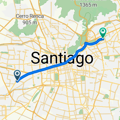
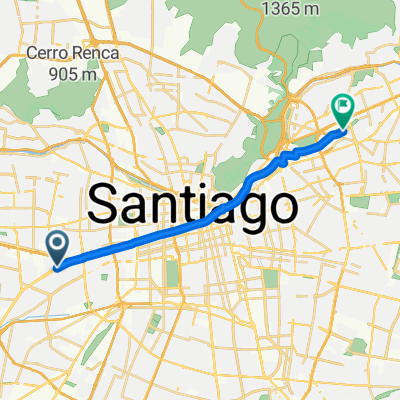
De Comandante Chac贸n 6174, Santiago a Comandante Chac贸n 6168, Santiago
A cycling route starting in Lo Prado, Santiago Metropolitan, Chile.
Overview
About this route
- 2 h 13 min
- Duration
- 13.1 km
- Distance
- 179 m
- Ascent
- 198 m
- Descent
- 5.9 km/h
- Avg. speed
- 527 m
- Avg. speed
Route photos
Route quality
Waytypes & surfaces along the route
Waytypes
Undefined
13.1 km
(100 %)
Surfaces
Undefined
13.1 km
(100 %)
Continue with Bikemap
Use, edit, or download this cycling route
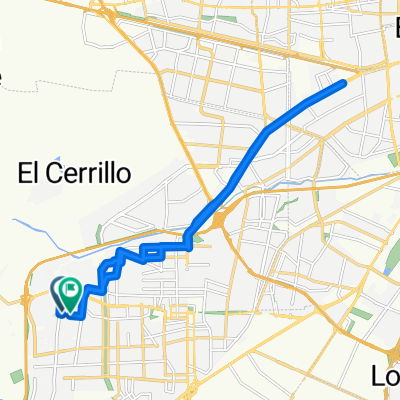
You would like to ride De Comandante Chac贸n 6174, Santiago a Comandante Chac贸n 6168, Santiago or customize it for your own trip? Here is what you can do with this Bikemap route:
Free features
- Save this route as favorite or in collections
- Copy & plan your own version of this route
- Sync your route with Garmin or Wahoo
Premium features
Free trial for 3 days, or one-time payment. More about Bikemap Premium.
- Navigate this route on iOS & Android
- Export a GPX / KML file of this route
- Create your custom printout (try it for free)
- Download this route for offline navigation
Discover more Premium features.
Get Bikemap PremiumFrom our community
Other popular routes starting in Lo Prado
- De Pasaje Barcelona 1554, Conchal铆 a Pasaje Barcelona 1553, Conchal铆
- Distance
- 16.5 km
- Ascent
- 562 m
- Descent
- 573 m
- Location
- Lo Prado, Santiago Metropolitan, Chile
- ruta hacia Laguna Piedra Roja
- Distance
- 40.1 km
- Ascent
- 538 m
- Descent
- 525 m
- Location
- Lo Prado, Santiago Metropolitan, Chile
- De Monterrey 2801, Conchal铆 a Nahuelbuta 1421, Conchal铆
- Distance
- 28.3 km
- Ascent
- 736 m
- Descent
- 751 m
- Location
- Lo Prado, Santiago Metropolitan, Chile
- Ruta a Balmaceda 4981, Talagante
- Distance
- 40.2 km
- Ascent
- 168 m
- Descent
- 273 m
- Location
- Lo Prado, Santiago Metropolitan, Chile
- De PI1265-Uspallata / Esq. Manuel Rodr铆guez, Estaci贸n Central a Ebro 2799, 脩u帽oa
- Distance
- 13.5 km
- Ascent
- 133 m
- Descent
- 0 m
- Location
- Lo Prado, Santiago Metropolitan, Chile
- Cuesta Barriga 13/06/21
- Distance
- 55.6 km
- Ascent
- 713 m
- Descent
- 711 m
- Location
- Lo Prado, Santiago Metropolitan, Chile
- De PI1656-Avenida Aeropuerto / Esq. Av. A. Vespucio, Cerrillos a Poiguano 10925, La Pintana
- Distance
- 13.8 km
- Ascent
- 314 m
- Descent
- 218 m
- Location
- Lo Prado, Santiago Metropolitan, Chile
- Ruta al Cementerio Quilicura
- Distance
- 9.8 km
- Ascent
- 51 m
- Descent
- 53 m
- Location
- Lo Prado, Santiago Metropolitan, Chile