

going to London
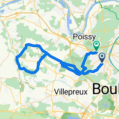
A cycling route starting in Mareil-Marly, Île-de-France Region, France.
Overview
About this route
- 10 h 1 min
- Duration
- 160 km
- Distance
- 1,090 m
- Ascent
- 1,097 m
- Descent
- 16 km/h
- Avg. speed
- 244 m
- Max. altitude

Route quality
Waytypes & surfaces along the route
Waytypes
Road
54.4 km
(34 %)
Path
43.2 km
(27 %)
Surfaces
Paved
97.6 km
(61 %)
Unpaved
3.2 km
(2 %)
Asphalt
92.8 km
(58 %)
Concrete
3.2 km
(2 %)
Continue with Bikemap
Use, edit, or download this cycling route
You would like to ride going to London or customize it for your own trip? Here is what you can do with this Bikemap route:
Free features
- Save this route as favorite or in collections
- Copy & plan your own version of this route
- Split it into stages to create a multi-day tour
- Sync your route with Garmin or Wahoo
Premium features
Free trial for 3 days, or one-time payment. More about Bikemap Premium.
- Navigate this route on iOS & Android
- Export a GPX / KML file of this route
- Create your custom printout (try it for free)
- Download this route for offline navigation
Discover more Premium features.
Get Bikemap PremiumFrom our community
Other popular routes starting in Mareil-Marly
 🚴🏿♀️Going to Work from Home 🏡
- Distance
- 17 km
- Ascent
- 139 m
- Descent
- 157 m
- Location
- Mareil-Marly, Île-de-France Region, France
 stage 1
- Distance
- 195.7 km
- Ascent
- 557 m
- Descent
- 593 m
- Location
- Mareil-Marly, Île-de-France Region, France
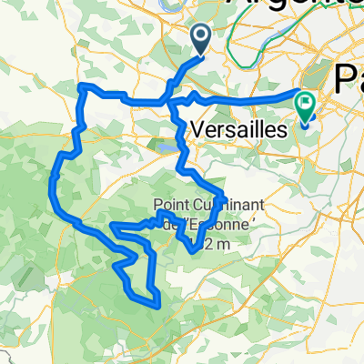
 Mareil-Versaille
- Distance
- 42.4 km
- Ascent
- 402 m
- Descent
- 400 m
- Location
- Mareil-Marly, Île-de-France Region, France
 54 Route de l'Étang-la-Ville, Mareil-Marly to 51 Avenue Carnot, Saint-Germain-en-Laye
- Distance
- 47.5 km
- Ascent
- 445 m
- Descent
- 407 m
- Location
- Mareil-Marly, Île-de-France Region, France
 Paris Nice 1ª
- Distance
- 134.2 km
- Ascent
- 795 m
- Descent
- 792 m
- Location
- Mareil-Marly, Île-de-France Region, France
 Mareil-Marly Cycling
- Distance
- 36.1 km
- Ascent
- 469 m
- Descent
- 465 m
- Location
- Mareil-Marly, Île-de-France Region, France
 Forest International School to Saint Nom la Breteche train station easy mountain bike road
- Distance
- 4.7 km
- Ascent
- 48 m
- Descent
- 81 m
- Location
- Mareil-Marly, Île-de-France Region, France
 5 Chemin de la Brèche (Mareil-Marly) - Chartres (28000), Eure-et-Loir, Centre-Val de Loire, France
- Distance
- 85.1 km
- Ascent
- 598 m
- Descent
- 584 m
- Location
- Mareil-Marly, Île-de-France Region, France
Open it in the app