
Pirker Zoigltour 85 km
A cycling route starting in Pirk, Bavaria, Germany.
Overview
About this route
Start und Ziel der Zoigltour, die jedes Jahr am ersten Sonntag im September vom VCC Pirk veranstaltet wird, liegen am Schulzentrum in Pirk gegenüber der modernen katholischen Pfarrkirche.
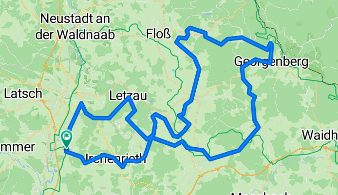
Die Zoigltour führt auf einer abwechslungsreiche Strecke durch den Naturpark "Nördlicher Oberpfälzer Wald" und stellt nach meinen Dafürhalten zusammen mit der Panoramatour in Windischeschenbach ein Highlight sowohl in sportlicher als auch in landschaftlicher Hinsicht dar. Immer wieder bieten sich herrliche Panoramablicke über den Oberpfälzer Wald. Das "Dach der Tour" bildet die Planer Höhe südöstlich von Waldkirch. Die daran anschließende Abfahrt über Gehenhammer, Georgenberg und durchs Zottbachtal bis Pleystein ist mehr als eine Entschädigung für den 5,25 km langen Anstieg von Flossenbürg bis zur Planer Höhe.
Zum Schluss noch ein Kompliment an die Veranstalter: eit 2004 fahre ich bei der Zoigltour mit und konnte nicht feststellen, dass die Qualität nachlässt - im Gegenteil, es sieht so aus, als ob die Veranstaltung jedes Jahr noch ein kleines bisschen besser würde. Nicht umsonst wird fast jedes Jahr ein neuer Teilnehmerrekord aufgestellt.
- -:--
- Duration
- 81.1 km
- Distance
- 737 m
- Ascent
- 737 m
- Descent
- ---
- Avg. speed
- ---
- Max. altitude

Route highlights
Points of interest along the route

Point of interest after 29.2 km
Kontrolle und Verpflegung

Point of interest after 65.5 km
Kontrolle und Verpflegung
Continue with Bikemap
Use, edit, or download this cycling route
You would like to ride Pirker Zoigltour 85 km or customize it for your own trip? Here is what you can do with this Bikemap route:
Free features
- Save this route as favorite or in collections
- Copy & plan your own version of this route
- Split it into stages to create a multi-day tour
- Sync your route with Garmin or Wahoo
Premium features
Free trial for 3 days, or one-time payment. More about Bikemap Premium.
- Navigate this route on iOS & Android
- Export a GPX / KML file of this route
- Create your custom printout (try it for free)
- Download this route for offline navigation
Discover more Premium features.
Get Bikemap PremiumFrom our community
Other popular routes starting in Pirk
 Pirker-Zoig-Tour 130 km
- Distance
- 123.6 km
- Ascent
- 1,204 m
- Descent
- 1,205 m
- Location
- Pirk, Bavaria, Germany
 kleine Tour durch die nördliche Oberpfalz (1)
- Distance
- 23.7 km
- Ascent
- 79 m
- Descent
- 79 m
- Location
- Pirk, Bavaria, Germany
 Pirker Zoigl Tour 2015 - 170 km
- Distance
- 170.1 km
- Ascent
- 1,679 m
- Descent
- 1,679 m
- Location
- Pirk, Bavaria, Germany
 Pirker Zoigltour 85 km
- Distance
- 81.1 km
- Ascent
- 737 m
- Descent
- 737 m
- Location
- Pirk, Bavaria, Germany
 Pirker Grenzerfahrung 2012
- Distance
- 224.3 km
- Ascent
- 1,613 m
- Descent
- 1,614 m
- Location
- Pirk, Bavaria, Germany
 Pirker Grenzerfahrung 2015 - 228 km
- Distance
- 226.7 km
- Ascent
- 1,709 m
- Descent
- 1,707 m
- Location
- Pirk, Bavaria, Germany
 Pirker Zoigl Tour 2013, 85 km
- Distance
- 80.5 km
- Ascent
- 749 m
- Descent
- 749 m
- Location
- Pirk, Bavaria, Germany
 Pirker-Zoigl-Tour 170km CLONED FROM ROUTE 428903
- Distance
- 169 km
- Ascent
- 1,538 m
- Descent
- 1,539 m
- Location
- Pirk, Bavaria, Germany
Open it in the app