
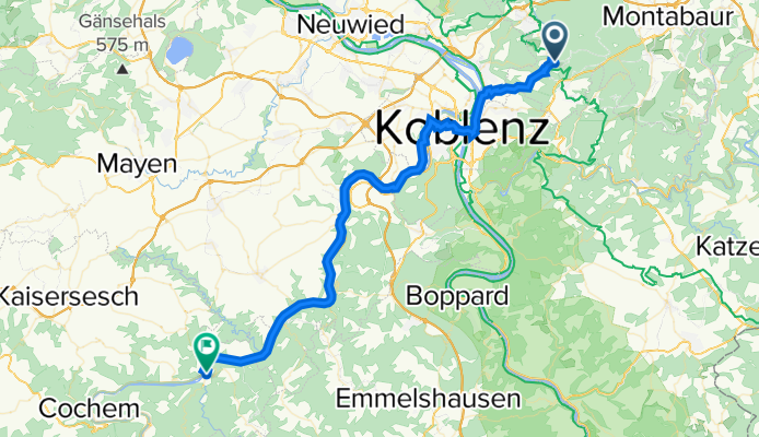
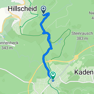
Koblenz - Treis-Karden
A cycling route starting in Hillscheid, Rhineland-Palatinate, Germany.
Overview
About this route
- -:--
- Duration
- 52.4 km
- Distance
- 457 m
- Ascent
- 689 m
- Descent
- ---
- Avg. speed
- 318 m
- Max. altitude

Route quality
Waytypes & surfaces along the route
Waytypes
Busy road
18.8 km
(36 %)
Quiet road
9.2 km
(17 %)
Surfaces
Paved
45.1 km
(86 %)
Unpaved
2.4 km
(5 %)
Asphalt
38.1 km
(73 %)
Paving stones
4.9 km
(9 %)
Continue with Bikemap
Use, edit, or download this cycling route
You would like to ride Koblenz - Treis-Karden or customize it for your own trip? Here is what you can do with this Bikemap route:
Free features
- Save this route as favorite or in collections
- Copy & plan your own version of this route
- Sync your route with Garmin or Wahoo
Premium features
Free trial for 3 days, or one-time payment. More about Bikemap Premium.
- Navigate this route on iOS & Android
- Export a GPX / KML file of this route
- Create your custom printout (try it for free)
- Download this route for offline navigation
Discover more Premium features.
Get Bikemap PremiumFrom our community
Other popular routes starting in Hillscheid
 Im Niederfeld 13, Hillscheid nach Im Niederfeld 12, Hillscheid
- Distance
- 59.1 km
- Ascent
- 971 m
- Descent
- 969 m
- Location
- Hillscheid, Rhineland-Palatinate, Germany
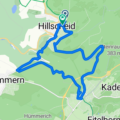 klein rondje Hillscheid
- Distance
- 11.9 km
- Ascent
- 257 m
- Descent
- 268 m
- Location
- Hillscheid, Rhineland-Palatinate, Germany
 Koblenz - Treis-Karden
- Distance
- 52.4 km
- Ascent
- 457 m
- Descent
- 689 m
- Location
- Hillscheid, Rhineland-Palatinate, Germany
 Entspannte Route
- Distance
- 11.6 km
- Ascent
- 191 m
- Descent
- 246 m
- Location
- Hillscheid, Rhineland-Palatinate, Germany
 Bachgasse 4, Hillscheid nach Kirchstraße 3, Neuhäusel
- Distance
- 4.1 km
- Ascent
- 125 m
- Descent
- 171 m
- Location
- Hillscheid, Rhineland-Palatinate, Germany
 Köppelrunde 1
- Distance
- 14.1 km
- Ascent
- 363 m
- Descent
- 365 m
- Location
- Hillscheid, Rhineland-Palatinate, Germany
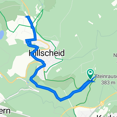
 Hüttenmühle 1, Hillscheid nach Bergstraße 79A, Höhr-Grenzhausen
- Distance
- 10.9 km
- Ascent
- 225 m
- Descent
- 174 m
- Location
- Hillscheid, Rhineland-Palatinate, Germany
 Am Waldsportplatz, Hillscheid to Bachgasse 4, Hillscheid
- Distance
- 2.4 km
- Ascent
- 146 m
- Descent
- 57 m
- Location
- Hillscheid, Rhineland-Palatinate, Germany
Open it in the app