

Overview
About this route
Ridden on June 4, 2023
From Paternion following the R1 to Molzbichl, very good to ride. From Molzbichl on municipal paths zigzagging to Spittal. From Möllbrücke it follows the Glockner cycle path, which from Obervellach is definitely a contender for an excellent five-star cycle route. It's a pity that the section from Penk to Obervellach is routed so awkwardly. Ideally, it would run along the Möll from Moos to Obervellach.
During the day, lightly cloudy with light rain, from afternoon heavy rain until Großkirchheim, the R8 is also very nice to ride in the rain!
Spittal is not a bicycle-friendly city. The cycle path??? Later briefly runs beside the B100, then on the B100, and the L9 to Lendorf near Spittal. For years I have been annoyed by the poor cycling infrastructure in Spittal an der Drau.
- -:--
- Duration
- 97.9 km
- Distance
- 1,299 m
- Ascent
- 807 m
- Descent
- ---
- Avg. speed
- 1,009 m
- Max. altitude

Part of
6 stages
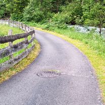
Route photos


Route quality
Waytypes & surfaces along the route
Waytypes
Track
38.2 km
(39 %)
Quiet road
35.2 km
(36 %)
Surfaces
Paved
45 km
(46 %)
Unpaved
12.7 km
(13 %)
Asphalt
33.3 km
(34 %)
Paved (undefined)
11.7 km
(12 %)
Continue with Bikemap
Use, edit, or download this cycling route
You would like to ride Paternion - Großkirchheim or customize it for your own trip? Here is what you can do with this Bikemap route:
Free features
- Save this route as favorite or in collections
- Copy & plan your own version of this route
- Split it into stages to create a multi-day tour
- Sync your route with Garmin or Wahoo
Premium features
Free trial for 3 days, or one-time payment. More about Bikemap Premium.
- Navigate this route on iOS & Android
- Export a GPX / KML file of this route
- Create your custom printout (try it for free)
- Download this route for offline navigation
Discover more Premium features.
Get Bikemap PremiumFrom our community
Other popular routes starting in Paternion
 Radtrip Feistritz Stadelbach
- Distance
- 18.2 km
- Ascent
- 60 m
- Descent
- 60 m
- Location
- Paternion, Carinthia, Austria
 Nikelsdorf-Gschriet-Fresach-Lansach-Nikelsdorf
- Distance
- 30 km
- Ascent
- 673 m
- Descent
- 699 m
- Location
- Paternion, Carinthia, Austria
 Paternion Villach Paternion
- Distance
- 66.1 km
- Ascent
- 265 m
- Descent
- 266 m
- Location
- Paternion, Carinthia, Austria
 Urlaub2022_10_Paternion - Grafenstein
- Distance
- 82.4 km
- Ascent
- 458 m
- Descent
- 561 m
- Location
- Paternion, Carinthia, Austria
 Feistritz - Ried - Goldeck - Kleinsasserhof - Feistritz
- Distance
- 40.7 km
- Ascent
- 837 m
- Descent
- 919 m
- Location
- Paternion, Carinthia, Austria
 Paternion - Villach
- Distance
- 24.3 km
- Ascent
- 96 m
- Descent
- 125 m
- Location
- Paternion, Carinthia, Austria
 Korutany - Drávská cyklostezka, Faakersee
- Distance
- 39.6 km
- Ascent
- 155 m
- Descent
- 112 m
- Location
- Paternion, Carinthia, Austria
 Nikelsdorf-Weissenbach-Bleiberg-WindischeHöhe-Nikelsdorf
- Distance
- 55.2 km
- Ascent
- 1,299 m
- Descent
- 1,017 m
- Location
- Paternion, Carinthia, Austria
Open it in the app