

2011Untertal bei Schladming
A cycling route starting in Schladming, Styria, Austria.
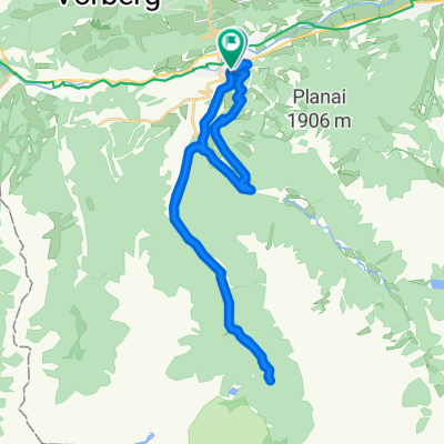
Overview
About this route
trip at the beginning of summer weather to the 'flat' (according to the geography expert!) Alpine side valley... of course it was a SINGLE ascent but still flat...
but the way is worth it because the valley is beautiful
- -:--
- Duration
- 23.9 km
- Distance
- 395 m
- Ascent
- 395 m
- Descent
- ---
- Avg. speed
- ---
- Max. altitude
Route highlights
Points of interest along the route
Point of interest after 4.4 km
UFF pause an Quelle...eher montainbikegeeignet das alles...aber halt n "FLACHES "steiles alpennebental!
Point of interest after 5.1 km
essenspause...dozzel zickt
Point of interest after 7.2 km
pause...unglaublicher blick ins untertal,wie gemalt so schön
Point of interest after 8.6 km
kaffepause
Point of interest after 10.3 km
hängemattenpause...dann zack kommt schlechtwetterfront-deckung
Point of interest after 12.1 km
längere pause,schlechtwetterfront zieht LANGSAM ab,dozzel zum wasserfall hoch,ich kann kaum gehen wegen hüftschmerzen...KOTZ
Continue with Bikemap
Use, edit, or download this cycling route
You would like to ride 2011Untertal bei Schladming or customize it for your own trip? Here is what you can do with this Bikemap route:
Free features
- Save this route as favorite or in collections
- Copy & plan your own version of this route
- Sync your route with Garmin or Wahoo
Premium features
Free trial for 3 days, or one-time payment. More about Bikemap Premium.
- Navigate this route on iOS & Android
- Export a GPX / KML file of this route
- Create your custom printout (try it for free)
- Download this route for offline navigation
Discover more Premium features.
Get Bikemap PremiumFrom our community
Other popular routes starting in Schladming
 Bahnhofstraße 428, Schladming nach Hauptplatz 261, Schladming
- Distance
- 22.1 km
- Ascent
- 417 m
- Descent
- 407 m
- Location
- Schladming, Styria, Austria
 sch-ram-filz-alt-rad-sch
- Distance
- 61.5 km
- Ascent
- 754 m
- Descent
- 753 m
- Location
- Schladming, Styria, Austria
 1.Tag Eschachalm
- Distance
- 32 km
- Ascent
- 732 m
- Descent
- 731 m
- Location
- Schladming, Styria, Austria
 2011Untertal bei Schladming
- Distance
- 23.9 km
- Ascent
- 395 m
- Descent
- 395 m
- Location
- Schladming, Styria, Austria
 2021_Ramsau- Thörlwandhütte-Bachlalm
- Distance
- 26.2 km
- Ascent
- 744 m
- Descent
- 742 m
- Location
- Schladming, Styria, Austria
 Enns-RW
- Distance
- 17.3 km
- Ascent
- 329 m
- Descent
- 331 m
- Location
- Schladming, Styria, Austria
 Ramsau Runde 01
- Distance
- 30.7 km
- Ascent
- 867 m
- Descent
- 867 m
- Location
- Schladming, Styria, Austria
 Schladming - Admont
- Distance
- 101.4 km
- Ascent
- 469 m
- Descent
- 646 m
- Location
- Schladming, Styria, Austria
Open it in the app