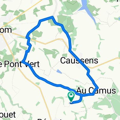
07-V. Condom - Pau (133 Km)
A cycling route starting in Condom, Occitanie, France.
Overview
About this route
- -:--
- Duration
- 133 km
- Distance
- 1,066 m
- Ascent
- 927 m
- Descent
- ---
- Avg. speed
- 418 m
- Max. altitude
Route quality
Waytypes & surfaces along the route
Waytypes
Quiet road
20 km
(15 %)
Road
6.7 km
(5 %)
Surfaces
Paved
75.8 km
(57 %)
Unpaved
4 km
(3 %)
Asphalt
71.8 km
(54 %)
Paved (undefined)
4 km
(3 %)
Route highlights
Points of interest along the route
Point of interest after 113.8 km
Sprint SOUMOULOU Km 133
Continue with Bikemap
Use, edit, or download this cycling route
You would like to ride 07-V. Condom - Pau (133 Km) or customize it for your own trip? Here is what you can do with this Bikemap route:
Free features
- Save this route as favorite or in collections
- Copy & plan your own version of this route
- Split it into stages to create a multi-day tour
- Sync your route with Garmin or Wahoo
Premium features
Free trial for 3 days, or one-time payment. More about Bikemap Premium.
- Navigate this route on iOS & Android
- Export a GPX / KML file of this route
- Create your custom printout (try it for free)
- Download this route for offline navigation
Discover more Premium features.
Get Bikemap PremiumFrom our community
Other popular routes starting in Condom
LePuy-Pamplona Etappe 09 Condom Aire-sur-l'Adour- Distance
- 74.6 km
- Ascent
- 494 m
- Descent
- 500 m
- Location
- Condom, Occitanie, France
VEZ dag 8 Condom - Lourdes- Distance
- 127.6 km
- Ascent
- 1,448 m
- Descent
- 1,136 m
- Location
- Condom, Occitanie, France
Condom - Toulouse par le Canal de la Garonne- Distance
- 141.2 km
- Ascent
- 334 m
- Descent
- 276 m
- Location
- Condom, Occitanie, France
07-V. Condom - Pau (133 Km)- Distance
- 133 km
- Ascent
- 1,066 m
- Descent
- 927 m
- Location
- Condom, Occitanie, France
11 Gaskoňsko 2011 - Barbotan- Distance
- 52 km
- Ascent
- 485 m
- Descent
- 457 m
- Location
- Condom, Occitanie, France
condom to perpignan- Distance
- 345 km
- Ascent
- 1,020 m
- Descent
- 1,070 m
- Location
- Condom, Occitanie, France
Jakobsweg Etappe 11 - Via Podiensis: Condom - Saint-Jean-Pied-de-Port CLONED FROM ROUTE 524679- Distance
- 212.4 km
- Ascent
- 1,122 m
- Descent
- 1,035 m
- Location
- Condom, Occitanie, France
Condom - La Reole- Distance
- 194.1 km
- Ascent
- 133 m
- Descent
- 138 m
- Location
- Condom, Occitanie, France
Open it in the app

