

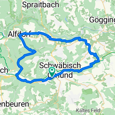
Abendliche Zeitfahrtrainingsrunde
A cycling route starting in Schwäbisch Gmünd, Baden-Wurttemberg, Germany.
Overview
About this route
On the railway trail to Straßdorf and then to Wäschebeuren. Lorch and back to Gmünd. Great to ride a time trial bike
- -:--
- Duration
- 27 km
- Distance
- 282 m
- Ascent
- 282 m
- Descent
- ---
- Avg. speed
- ---
- Max. altitude

Continue with Bikemap
Use, edit, or download this cycling route
You would like to ride Abendliche Zeitfahrtrainingsrunde or customize it for your own trip? Here is what you can do with this Bikemap route:
Free features
- Save this route as favorite or in collections
- Copy & plan your own version of this route
- Sync your route with Garmin or Wahoo
Premium features
Free trial for 3 days, or one-time payment. More about Bikemap Premium.
- Navigate this route on iOS & Android
- Export a GPX / KML file of this route
- Create your custom printout (try it for free)
- Download this route for offline navigation
Discover more Premium features.
Get Bikemap PremiumFrom our community
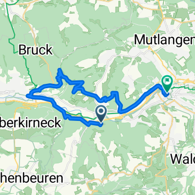
Other popular routes starting in Schwäbisch Gmünd
 Paradiesstraße 24, Schwäbisch Gmünd nach Paradiesstraße 24, Schwäbisch Gmünd
- Distance
- 14.8 km
- Ascent
- 0 m
- Descent
- 13 m
- Location
- Schwäbisch Gmünd, Baden-Wurttemberg, Germany
 00000
00000- Distance
- 15.2 km
- Ascent
- 234 m
- Descent
- 236 m
- Location
- Schwäbisch Gmünd, Baden-Wurttemberg, Germany
 Schwäbisch Gmünd nach Asylstraße 1, Schwäbisch Gmünd
- Distance
- 17.9 km
- Ascent
- 191 m
- Descent
- 215 m
- Location
- Schwäbisch Gmünd, Baden-Wurttemberg, Germany
 Rund um Schwäbisch Gmünd
- Distance
- 101.1 km
- Ascent
- 954 m
- Descent
- 949 m
- Location
- Schwäbisch Gmünd, Baden-Wurttemberg, Germany
 alb rauf und runter
- Distance
- 98.6 km
- Ascent
- 1,359 m
- Descent
- 1,361 m
- Location
- Schwäbisch Gmünd, Baden-Wurttemberg, Germany
 Gmünd - Zimmern - Lindach - Alfdorf - Haselbach - Gmünd
- Distance
- 37.5 km
- Ascent
- 277 m
- Descent
- 277 m
- Location
- Schwäbisch Gmünd, Baden-Wurttemberg, Germany
 Schw. Gmünd - Straßdorf - Aasrücken - Waldhausen - Schw. Gmünd
- Distance
- 39.2 km
- Ascent
- 512 m
- Descent
- 512 m
- Location
- Schwäbisch Gmünd, Baden-Wurttemberg, Germany
 Ulm,Arneg
- Distance
- 59.7 km
- Ascent
- 731 m
- Descent
- 572 m
- Location
- Schwäbisch Gmünd, Baden-Wurttemberg, Germany
Open it in the app