

High Street 484, Motueka to Inlet Road 10, Kaiteriteri
A cycling route starting in Motueka, Tasman District, New Zealand.
Overview
About this route
- 1 h 51 min
- Duration
- 20.1 km
- Distance
- 106 m
- Ascent
- 111 m
- Descent
- 10.8 km/h
- Avg. speed
- 64 m
- Max. altitude

Continue with Bikemap
Use, edit, or download this cycling route
You would like to ride High Street 484, Motueka to Inlet Road 10, Kaiteriteri or customize it for your own trip? Here is what you can do with this Bikemap route:
Free features
- Save this route as favorite or in collections
- Copy & plan your own version of this route
- Sync your route with Garmin or Wahoo
Premium features
Free trial for 3 days, or one-time payment. More about Bikemap Premium.
- Navigate this route on iOS & Android
- Export a GPX / KML file of this route
- Create your custom printout (try it for free)
- Download this route for offline navigation
Discover more Premium features.
Get Bikemap PremiumFrom our community
Other popular routes starting in Motueka
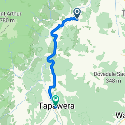 Motueka - Tapawera
- Distance
- 30.4 km
- Ascent
- 261 m
- Descent
- 157 m
- Location
- Motueka, Tasman District, New Zealand
 Motueka to richmond
- Distance
- 44.3 km
- Ascent
- 126 m
- Descent
- 122 m
- Location
- Motueka, Tasman District, New Zealand
 2334–2434 Motueka River West Bank Rd, Motueka to 90 Main Road Tapawera, Wakefield
- Distance
- 33.2 km
- Ascent
- 411 m
- Descent
- 328 m
- Location
- Motueka, Tasman District, New Zealand
 Recovered Route
- Distance
- 25.3 km
- Ascent
- 369 m
- Descent
- 315 m
- Location
- Motueka, Tasman District, New Zealand
 523B Main Road Riwaka, Motueka to 8 Matai Cres, Wakefield
- Distance
- 50.3 km
- Ascent
- 636 m
- Descent
- 488 m
- Location
- Motueka, Tasman District, New Zealand
 High Street 484, Motueka to Inlet Road 10, Kaiteriteri
- Distance
- 20.1 km
- Ascent
- 106 m
- Descent
- 111 m
- Location
- Motueka, Tasman District, New Zealand
 Martin Farm Road 37, Kaiteriteri to Martin Farm Road 37, Kaiteriteri
- Distance
- 6.6 km
- Ascent
- 251 m
- Descent
- 268 m
- Location
- Motueka, Tasman District, New Zealand
 168 Staples St, Motueka to 1 Kaiteriteri-Sandy Bay Rd, Motueka
- Distance
- 12.8 km
- Ascent
- 193 m
- Descent
- 189 m
- Location
- Motueka, Tasman District, New Zealand
Open it in the app