
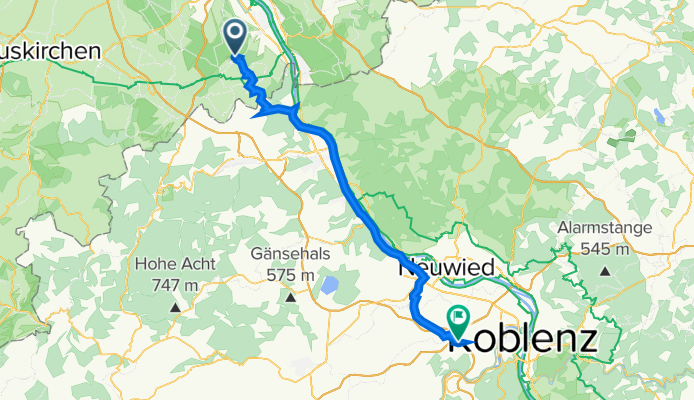
Huppenbergstraße 43, Wachtberg nach Am Autobahnkreuz 7, Koblenz
A cycling route starting in Wachtberg, North Rhine-Westphalia, Germany.
Overview
About this route
- 5 h 37 min
- Duration
- 55.1 km
- Distance
- 448 m
- Ascent
- 444 m
- Descent
- 9.8 km/h
- Avg. speed
- 242 m
- Avg. speed

Route quality
Waytypes & surfaces along the route
Waytypes
Quiet road
13.5 km
(25 %)
Road
12.6 km
(23 %)
Surfaces
Paved
42 km
(76 %)
Unpaved
2.2 km
(4 %)
Asphalt
33.4 km
(61 %)
Paving stones
6.9 km
(13 %)
Continue with Bikemap
Use, edit, or download this cycling route
You would like to ride Huppenbergstraße 43, Wachtberg nach Am Autobahnkreuz 7, Koblenz or customize it for your own trip? Here is what you can do with this Bikemap route:
Free features
- Save this route as favorite or in collections
- Copy & plan your own version of this route
- Sync your route with Garmin or Wahoo
Premium features
Free trial for 3 days, or one-time payment. More about Bikemap Premium.
- Navigate this route on iOS & Android
- Export a GPX / KML file of this route
- Create your custom printout (try it for free)
- Download this route for offline navigation
Discover more Premium features.
Get Bikemap PremiumFrom our community
Other popular routes starting in Wachtberg
 Recovered Route
- Distance
- 96.3 km
- Ascent
- 416 m
- Descent
- 540 m
- Location
- Wachtberg, North Rhine-Westphalia, Germany
 Apfelroute 6 Wachtberg-Schleife
- Distance
- 18.9 km
- Ascent
- 192 m
- Descent
- 190 m
- Location
- Wachtberg, North Rhine-Westphalia, Germany
 Zwei Hüttentour: Zur Akropolis und dann zum Steinerberghaus rauf
- Distance
- 42.8 km
- Ascent
- 865 m
- Descent
- 847 m
- Location
- Wachtberg, North Rhine-Westphalia, Germany
 hausrunde werthhoven
- Distance
- 31.8 km
- Ascent
- 303 m
- Descent
- 367 m
- Location
- Wachtberg, North Rhine-Westphalia, Germany
 Landskron
- Distance
- 26 km
- Ascent
- 569 m
- Descent
- 568 m
- Location
- Wachtberg, North Rhine-Westphalia, Germany
 An den Obstgärten 17, Wachtberg nach An den Obstgärten 18, Wachtberg
- Distance
- 55.5 km
- Ascent
- 689 m
- Descent
- 682 m
- Location
- Wachtberg, North Rhine-Westphalia, Germany
 Golfplatz Züllighoven und ins Tal nach Calmuth
- Distance
- 30.5 km
- Ascent
- 335 m
- Descent
- 335 m
- Location
- Wachtberg, North Rhine-Westphalia, Germany
 An den Obstgärten 15, Wachtberg nach An den Obstgärten 17, Wachtberg
- Distance
- 75.9 km
- Ascent
- 991 m
- Descent
- 991 m
- Location
- Wachtberg, North Rhine-Westphalia, Germany
Open it in the app