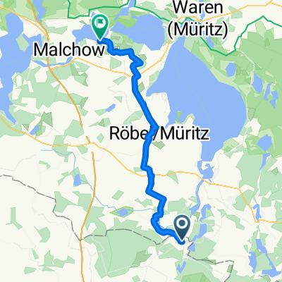
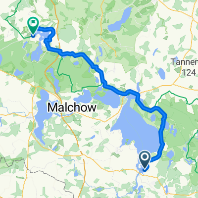
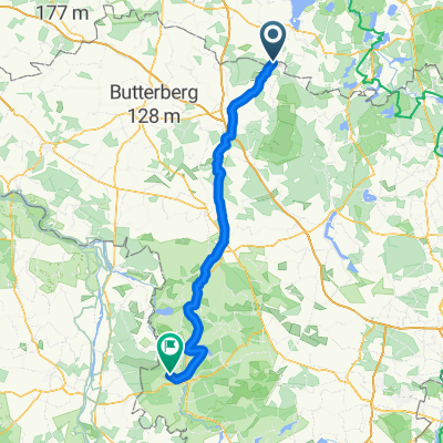
Canutour Nord C34-20,3
A cycling route starting in Rechlin, Mecklenburg-Vorpommern, Germany.
Overview
About this route
Hello everyone, although this is a page for cyclists, I want to share my over 10 years of experience in MeckPom with canoeing.
We have been going to the HAVELBERGE campsite near Wesenberg for 12 years now. From there, we are transported daily with the van and the canoes to start our tours.
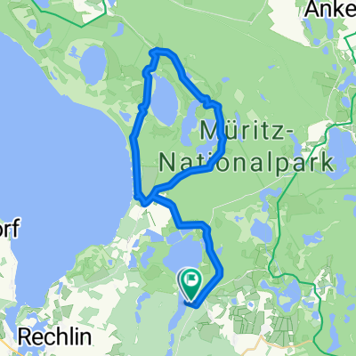
Here is the northern tour from the swimming area Pagelsee to C34. On the tour, there is a fisherman at BABKE, a simple eatery in BLANKENFÖRDE, and at the exit of USERISEE, there is a lock that must be portaged with the lore, in KLEIN QUASSOW there is good gastronomy near the bridge and before you know it, you are back at the campsite.
I will soon add more already paddled routes here.
- -:--
- Duration
- 20.3 km
- Distance
- 45 m
- Ascent
- 47 m
- Descent
- ---
- Avg. speed
- ---
- Max. altitude
Continue with Bikemap
Use, edit, or download this cycling route
You would like to ride Canutour Nord C34-20,3 or customize it for your own trip? Here is what you can do with this Bikemap route:
Free features
- Save this route as favorite or in collections
- Copy & plan your own version of this route
- Sync your route with Garmin or Wahoo
Premium features
Free trial for 3 days, or one-time payment. More about Bikemap Premium.
- Navigate this route on iOS & Android
- Export a GPX / KML file of this route
- Create your custom printout (try it for free)
- Download this route for offline navigation
Discover more Premium features.
Get Bikemap PremiumFrom our community
Other popular routes starting in Rechlin
- Boek-Jabel
- Distance
- 36.8 km
- Ascent
- 137 m
- Descent
- 131 m
- Location
- Rechlin, Mecklenburg-Vorpommern, Germany
- Boeker Mühle
- Distance
- 27.7 km
- Ascent
- 136 m
- Descent
- 135 m
- Location
- Rechlin, Mecklenburg-Vorpommern, Germany
- Mirow Runde mit Kinder Und Badestopps
- Distance
- 40.6 km
- Ascent
- 138 m
- Descent
- 135 m
- Location
- Rechlin, Mecklenburg-Vorpommern, Germany
- Müritzrundweg
- Distance
- 86.7 km
- Ascent
- 160 m
- Descent
- 160 m
- Location
- Rechlin, Mecklenburg-Vorpommern, Germany
- Kombitour Kajak + Fahrrad
- Distance
- 180.9 km
- Ascent
- 181 m
- Descent
- 180 m
- Location
- Rechlin, Mecklenburg-Vorpommern, Germany
- Müritzrundweg
- Distance
- 91.6 km
- Ascent
- 199 m
- Descent
- 189 m
- Location
- Rechlin, Mecklenburg-Vorpommern, Germany
- ucker boek federow
- Distance
- 46.9 km
- Ascent
- 114 m
- Descent
- 114 m
- Location
- Rechlin, Mecklenburg-Vorpommern, Germany
- Große Mirower Seenrunde
- Distance
- 65.4 km
- Ascent
- 198 m
- Descent
- 196 m
- Location
- Rechlin, Mecklenburg-Vorpommern, Germany
Open it in the app