castelfabib>teruel
A cycling route starting in Teruel, Aragon, Spain.
Overview
About this route
- 28 h 27 min
- Duration
- 276 km
- Distance
- 6,300 m
- Ascent
- 6,302 m
- Descent
- 9.7 km/h
- Avg. speed
- 2,004 m
- Avg. speed
Route quality
Waytypes & surfaces along the route
Waytypes
Track
142.5 km
(52 %)
Road
48.4 km
(18 %)
Surfaces
Paved
19.9 km
(7 %)
Unpaved
104.7 km
(38 %)
Gravel
43.2 km
(16 %)
Ground
36.4 km
(13 %)
Continue with Bikemap
Use, edit, or download this cycling route
You would like to ride castelfabib>teruel or customize it for your own trip? Here is what you can do with this Bikemap route:
Free features
- Save this route as favorite or in collections
- Copy & plan your own version of this route
- Sync your route with Garmin or Wahoo
Premium features
Free trial for 3 days, or one-time payment. More about Bikemap Premium.
- Navigate this route on iOS & Android
- Export a GPX / KML file of this route
- Create your custom printout (try it for free)
- Download this route for offline navigation
Discover more Premium features.
Get Bikemap PremiumFrom our community
Other popular routes starting in Teruel
- 20100530-Via Verde
- Distance
- 132.7 km
- Ascent
- 358 m
- Descent
- 1,150 m
- Location
- Teruel, Aragon, Spain
- Teruel-Sagunto
- Distance
- 149.5 km
- Ascent
- 379 m
- Descent
- 1,257 m
- Location
- Teruel, Aragon, Spain
- 1 Teruel-Albarracín-Guadalaviar
- Distance
- 79.6 km
- Ascent
- 1,327 m
- Descent
- 667 m
- Location
- Teruel, Aragon, Spain
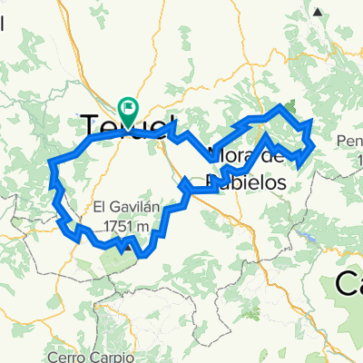
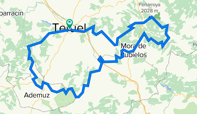
- Teruel-MoraRubielos-Valdelinares-Teruel
- Distance
- 132.1 km
- Ascent
- 1,736 m
- Descent
- 1,726 m
- Location
- Teruel, Aragon, Spain
- Teruel - Mora de Rubielos
- Distance
- 48.5 km
- Ascent
- 508 m
- Descent
- 402 m
- Location
- Teruel, Aragon, Spain
- ESP 031: Via Verde Ojos Negros (Mittlerer Abschnitt)
- Distance
- 71.3 km
- Ascent
- 871 m
- Descent
- 871 m
- Location
- Teruel, Aragon, Spain
- Teruel-Dernaque-Valdecuenca-Toril-Javalambre-Teruel
- Distance
- 195.1 km
- Ascent
- 2,119 m
- Descent
- 2,127 m
- Location
- Teruel, Aragon, Spain
- MINA DE OJOS NEGROS, TRAMO TERUEL-BARRACAS-JERICA
- Distance
- 98 km
- Ascent
- 774 m
- Descent
- 1,027 m
- Location
- Teruel, Aragon, Spain
Open it in the app