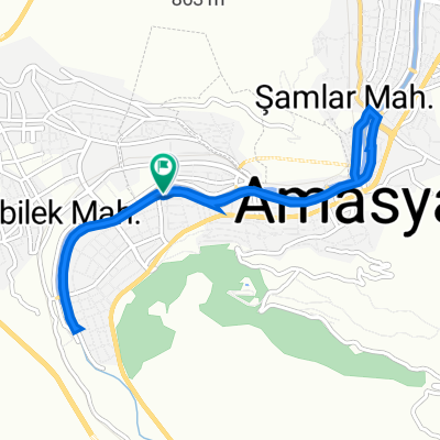
V_ANT-ANK (Amasya - Bafra Fener)
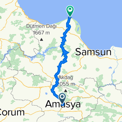
A cycling route starting in Amasya, Amasya Province, Turkey.
Overview
About this route
- -:--
- Duration
- 182.9 km
- Distance
- 2,630 m
- Ascent
- 3,024 m
- Descent
- ---
- Avg. speed
- 961 m
- Avg. speed
Route quality
Waytypes & surfaces along the route
Waytypes
Road
93.8 km
(51 %)
Busy road
47.2 km
(26 %)
Surfaces
Paved
17.3 km
(9 %)
Unpaved
3 km
(2 %)
Asphalt
17.3 km
(9 %)
Unpaved (undefined)
3 km
(2 %)
Undefined
162.6 km
(89 %)
Continue with Bikemap
Use, edit, or download this cycling route
You would like to ride V_ANT-ANK (Amasya - Bafra Fener) or customize it for your own trip? Here is what you can do with this Bikemap route:
Free features
- Save this route as favorite or in collections
- Copy & plan your own version of this route
- Sync your route with Garmin or Wahoo
Premium features
Free trial for 3 days, or one-time payment. More about Bikemap Premium.
- Navigate this route on iOS & Android
- Export a GPX / KML file of this route
- Create your custom printout (try it for free)
- Download this route for offline navigation
Discover more Premium features.
Get Bikemap PremiumFrom our community
Other popular routes starting in Amasya
- Tag3.4N Amasya-Niksar
- Distance
- 124.8 km
- Ascent
- 576 m
- Descent
- 815 m
- Location
- Amasya, Amasya Province, Turkey
- Amasya - Havza
- Distance
- 47.2 km
- Ascent
- 355 m
- Descent
- 77 m
- Location
- Amasya, Amasya Province, Turkey
- karadeniz rota-2
- Distance
- 668.3 km
- Ascent
- 1,162 m
- Descent
- 1,683 m
- Location
- Amasya, Amasya Province, Turkey
- Amasya-Susehri
- Distance
- 232.1 km
- Ascent
- 1,070 m
- Descent
- 398 m
- Location
- Amasya, Amasya Province, Turkey
- trwe4rwe
- Distance
- 1,108.8 km
- Ascent
- 5,497 m
- Descent
- 4,300 m
- Location
- Amasya, Amasya Province, Turkey
- V_001
- Distance
- 37.8 km
- Ascent
- 635 m
- Descent
- 103 m
- Location
- Amasya, Amasya Province, Turkey
- Amasya-Ordu
- Distance
- 280 km
- Ascent
- 1,239 m
- Descent
- 1,623 m
- Location
- Amasya, Amasya Province, Turkey
- Helvaci - Turhal
- Distance
- 70 km
- Ascent
- 477 m
- Descent
- 343 m
- Location
- Amasya, Amasya Province, Turkey
Open it in the app